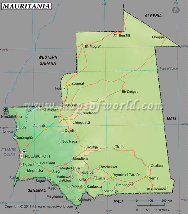
Mauritania is located within the latitude and longitude of 20° 00 N, 12º 00 W. The Islamic Republic of Mauritania is located in northwest Africa.
It is surrounded by the Atlantic Ocean on the west, Senegal on the southwest, Mali on the east and southeast, Algeria on the northeast, and by the Moroccan-annexed territory of Western Sahara on the northwest. The capital city of Mauritania is Nouakchott. The latitude and longitude of Nouakchott, the capital city of Mauritania country is 18º 06' N, 15º 57' W. Mauritania is 5 hours ahead of Washington, DC during Standard Time.
The latitude and longitude of Mauritania covers 1,030,700 sq km of total land area.Approximately three-fourth land within the latitude and longitude of Mauritania is desert. As it is a desert area the climate within latitude and longitude of Mauritania remains constantly hot, dry and dusty.
| Locations |
Latitude |
Longitude |
| Adrar | 20°30'N | 07°30'E |
| Ain Ben Tili | 25°59'N | 09°27'W |
| Akjoujt | 19°45'N | 14°15'W |
| Aleg | 17°03'N | 13°55'W |
| Aoukar | 17°40'N | 10°00'W |
| Atar | 20°30'N | 13°05'W |
| Ayoun el 'Atrous, | 16°38'N | 09°37'W |
| Bir Mogrein | 25°10'N | 11°25'W |
| Chegga | 25°27'N | 05°40'W |
| Chinguetti | 20°25'N | 12°24'W |
| El Djouf | 20°00'N | 09°00'W |
| Fderik | 22°40'N | 12°45'W |
Last Updated on: November 18th, 2017
