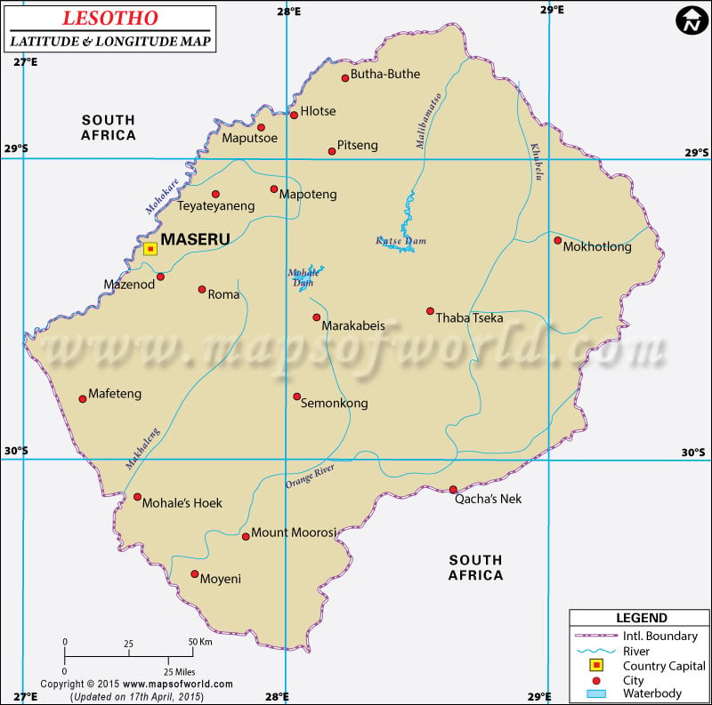
The Kingdom of
Lesotho has it's
geographic coordinates in Southern Africa, at 29°00'S
latitude and 28°00'E
longitude .
The country of Lesotho , also known as Muso oa Lesotho in the Sesotho Language, was earlier known as Basutoland. Lesotho means Land of the Sotho speaking people. The latitudes and longitudes of Lebanon spans across an area of 30,355 sq km. The capital of Lesotho is Maseru, having geographic coordinates of 29°18'S latitude and 27°28'E longitude.
The population of Lesotho is estimated at 2,125,262, the numbers may vary due to the high mortality rate due to fatal infections like AIDS. The population has an ethnic majority of Sothos followed by Europeans and Asian races.
The
latitude and longitude of the geographic coordinates of Lesotho influence the Climate in the area. The temperate climate ranges from pleasantly cool to freezing temperatures in winter. The winters are dry with periods of occasional drought. Summers are hot and wet. The terrain of Lesotho is mainly uneven with highlands, plateaus, hills, and mountains. The highest peak in the region is the Thabana Ntlenyana which has a height of 3,482 m.
| Locations |
Latitude |
Longitude |
| Leribe | 28°51'S | 28°03'E |
| Maseru | 29°18'S | 27°30'E |
| Mohales Hoek | 30°07'S | 27°26'E |
| Mokhotlong | 29°22'S | 29°02'E |
| Quthing | 30°25'S | 27°36'E |
| Sources Mt. Aux | 28°45'S | 28°50'E |
| Thaba Putsoa | 29°45'S | 28°0'E |
Last Updated on: November 18th, 2017
