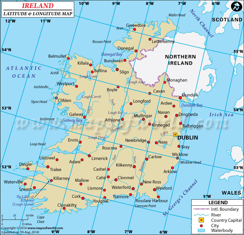
The geographical alignment of
Ireland indicates
latitude of 53° 00' N and
longitude of 8° 00' W. The particular
latitude of Ireland suggests its location in Northern Hemisphere.
The country of Ireland has integrated the five-sixths part of Ireland Island amid the North Atlantic Ocean. This terrain is located to the west of Great Britain.
The country of Ireland contains 70,280 square kilometers of area in the Western region of Europe.
The gently sloping plain land of this country is encompassed by hills and crags. Numbers of marine cliffs are found on the western coastal zone.
The characteristic of Ireland's climatic condition is its average consistent temperature. The 'maritime temperate' climatic condition of Ireland is featured by gentle winter season along with humid and slightly cool summer. Almost half of the seasons are Cloudy.
The
latitude and the longitude of
Dublin the capital of
Ireland are 53° 20' N and 6° 15' W respectively. The time followed in Iceland is as per UTC (0).
Latitude and Longitude of Ireland |
|---|
Last Updated on: November 17th, 2017


