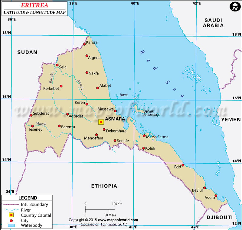
The country of
Eritrea , which presently is a part of the eastern side of the African continent, occupies the
latitude and longitude of 15 00 N and 39 00 E respectively. The country of Eritrea had for 30 long years been a province of Ethiopia and only very recently in 1993 did it achieve complete independence.
Eritrea spreads across a total area of 121,320 sq km and its latitude and longitude attributes gives it a position right beside the Red sea. The capital of Eritrea is Asmara, which further occupies the latitude and longitude denominations of 15 20 N and 38 53 E respectively. The latitude and longitude attributes of some other important places in Eritrea are 13°00N and 42°40E in Assab, 15°30N and 37°40E in Akordat and 13°00N and 42°40E in Aseb.
The latitude and longitude denomination of Eritrea gives the place a climate which is predominantly hot and sometimes scorching, because of the dry strip of desert that runs beside the Red sea. However, temperatures in the central highlands are comparatively cooler and there is periodic and seasonal rainfall. The hills and plains on the western side of Eritrea can be called semi-arid.
Latitude and Longitude of Eritrea |
|---|
| Locations | Latitude | Longitude |
|---|
| Akordat | 15°30'N | 37°40'E |
| Aseb | 13°00'N | 42°40'E |
| Asmara/Asmera | 15°19'N | 38°55'E |
| Asmera | 15°19'N | 38°55'E |
| Assab/Aseb | 13°00'N | 42°40'E |
| Dahlak Kebri | 15°50'N | 40°10'E |
| Massawa/Mitsiwa | 15°35'N | 39°25'E |
| Mitsiwa | 15°35'N | 39°25'E |
| Nakfa | 16°40'N | 38°32'E |
Last Updated on: November 13th, 2017


