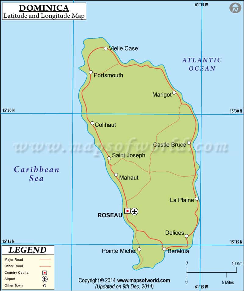
The small and picturesque island of
Dominica that lies in the Caribbean occupies the
latitude and longitude of 15°25N and 61°20W respectively.
The small island of Dominica has a total population of 70000 of which 20000 are concentrated in the capital city of Roseau that further lies in the latitude and longitude of 15°20N and 61°24W respectively. From the occupation of the specific latitude and longitude of Dominica , the climate that the country would experience can be well guessed.
Being a Caribbean island the country of Dominica faces a tropical kind of climate but the climate cannot be said to be extreme. Even during winters the temperature lies around the 25°C mark and in summers there is again not much variation with the temperature not rising above the 28°C mark.
Summers usher in heavy showers of rainfall and also intermittent hurricanes. However, in this mountainous terrain called Dominica, spring is the driest of all months.
Latitude and Longitude of Dominica |
|---|
| Location | Latitude | Longitude |
|---|
| Portsmouth | 11°08'N | 42°20'E |
| Dikkil = Dikhil | 11°08'N | 42°20'E |
| Dominica | 11°30'N | 43°05'E |
Last Updated on: November 10th, 2017


