logo


Democratic Republic of Congo Latitude and Longitude Map
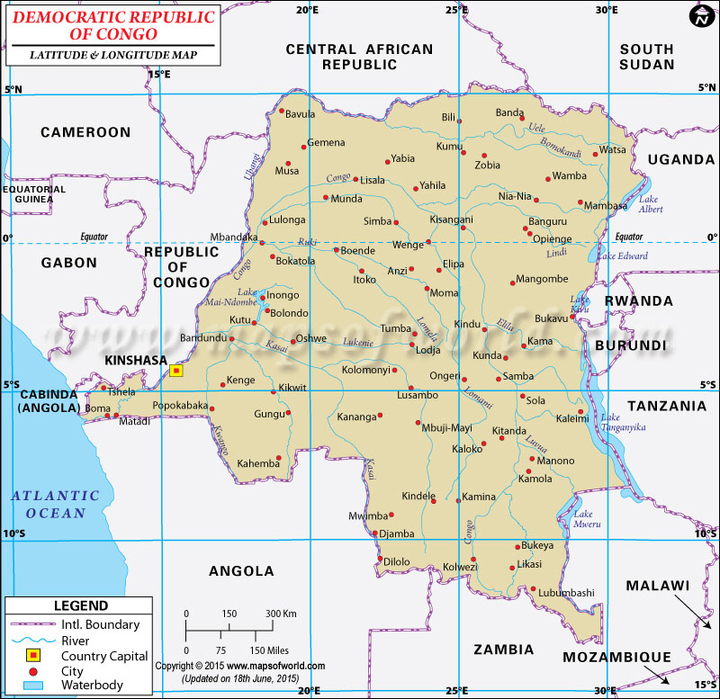
Democratic Republic of Congo Latitude and Longitude Map Cameroon Lat Long Central African Republic Lat Long Republic of Congo Equatorial Guinea Lat Long Gabon Lat Long Angola Lat Long Mozambique Lat Long Malawi Lat Long Zambia Lat Long Tanzania Lat long Burundi Lat Long Rwanda Lat long Uganda Lat Long South Sudan Lat Long
Description : Map showing the latitude and longitude of Democratic Republic of Congo provinces, major cities and towns. Disclaimer
×

Disclaimer  :  All efforts have been made to make this image accurate. However MapSherpa, Inc, its directors and employees do not own any responsibility for the correctness or authenticity of the same.


Search For Latitude & Longitude Map

By Country

Or

Latitude

Longitude

Or

Area

* Put South & West values with minus ( - ) sign.


Last Updated on: November 10th, 2017