The main
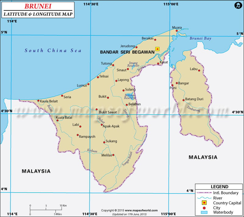
latitude and longitude of Brunei is 4° 30'North and 114° 40' East. This South East Asian country lies very near to
the equator and quiet far from the prime meridian. The area of 5,770 square kilometer of the country falls between the first and last
latitude and longitude of Brunei. The close proximity of the
latitude of Brunei to the equator is responsible for its hot and humid climate. There are long hot summers in
Brunei and very high amount of Rainfall like any other tropical country.
The
latitude and longitude of the capital of Brunei, Bandar Seri Begawan, is 4° 55'North and 114° 55'East. The
longitudes of Brunei is very far from the Prime Meridian and the time followed is eight hours ahead of the Greenwich Mean Time (UTC+8).
Latitude and Longitude of Brunei |
|---|
| Location | Latitude | Longitude |
|---|
| Bandar Seri Begawan | 04°52'N | 115°00'E |
| Brunei/Bandar Seri Begawan | 04°52'N | 115°00'E |
| Limbang | 04°42'N | 115°06'E |
| Seria | 4°37'N | 114°23'E |
| Tutong | 4°47'N | 114°40'E |
Last Updated on: November 9th, 2017


