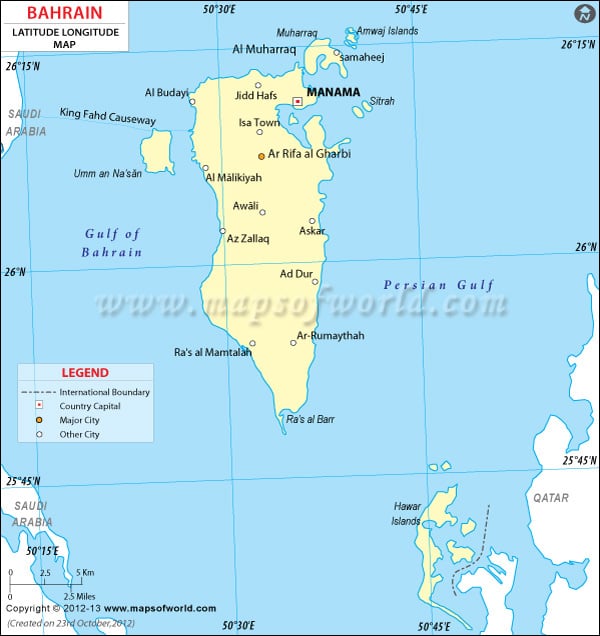
The latitude and longitude of
Bahrain is 26° 00' North and 50° 33' East respectively.
Situated among a group of thirty three islands which are located near the east coastline of Saudi Arabia, Bahrain has got distinctive weather because of its
latitude and longitude .
Bahrain has a particular type of weather as a result of its location in a certain latitude and longitudinal area. Climate in Bahrain has mainly two trends. Summer weather is very hot and highly humid and weather in winter is very pleasant with mild, cool and clear climate. Rainfall in Bahrain mainly occurs during the winter season. During summer, the humid weather is made cool by the 'Al Barah' winds.
| Location | Latitude | Longitude |
|---|
| Al Manamah |
26°10'N |
50°30'E |
| Al Muharraq |
26°15'N |
50°40'E |
| Awali |
26°00'N |
50°30'E |
| Manama/Al Manamah |
23°10'N |
50°30'E |
Last Updated on: November 8th, 2017


