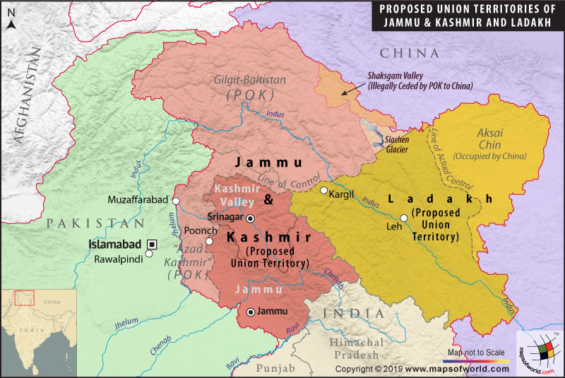
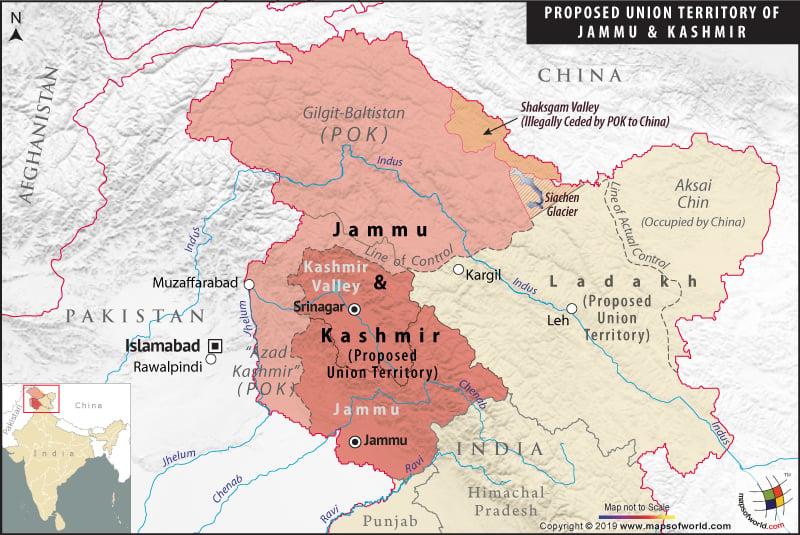
Jammu and Kashmir Proposed Map

Description :The Map showing all the districts in the state J&K, state capital, district HQ and district boundaries.


| Description :The Map showing all the districts in the state J&K, state capital, district HQ and district boundaries. |

| Description :The Map showing all the districts in the state J&K, state capital, district HQ and district boundaries. |

| Description :The Map showing all the districts in the state J&K, state capital, district HQ and district boundaries. |
List of Jammu division |
|---|
| Name of District | Headquarters | Area (km²) | Population (2011 Census) |
|---|---|---|---|
| Doda District | Doda | 2,306 | 409,576 |
| Jammu District | Jammu | 3,097 | 1,526,406 |
| Kathua District | Kathua | 2,651 | 615,711 |
| Kishtwar District | Kishtwar | 7,737 | 231,037 |
| Poonch District | Poonch | 1,674 | 476,820 |
| Rajouri District | Rajouri | 2,630 | 619,266 |
| Ramban District | Ramban | 1,329 | 283,313 |
| Reasi District | Reasi | 1,719 | 314,714 |
| Samba District | Samba | 904 | 318,611 |
| Udhampur District | Udhampur | 4,550 | 555,357 |
| Total | 26,293 | 5,350,811 |
List of Kashmir valley division |
|---|
| Name of District | Headquarters | Area (km²) | Population (2011 Census) |
|---|---|---|---|
| Anantnag District | Anantnag | 3,984 | 1,069,749 |
| Bandipora District | Bandipora | 398 | 385,099 |
| Baramulla district | Baramulla | 4,588 | 1,015,503 |
| Budgam District | Budgam | 1,371 | 755,331 |
| Ganderbal District | Ganderbal | 259 | 297,003 |
| Kulgam District | Kulgam | 1,067 | 423,181 |
| Kupwara District | Kupwara | 2,379 | 875,564 |
| Pulwama District | Pulwama | 1,398 | 570,060 |
| Shopian District | Shopian | 613 | 265,960 |
| Srinagar District | Srinagar | 2,228 | 1,250,173 |
| Total | 15,948 | 6,907,623 |
List of Ladakh division |
|---|
| Name of District | Headquarters | Area (km²) | Population (2011 Census) |
|---|---|---|---|
| Kargil District | Kargil | 14,036 | 143,388 |
| Leh District | Leh | 45,110 | 147,104 |
| Total | 59,146 | 290,492 |
Jammu and Kashmir Railway Map shows the district’s rail network of Jammu and Kashmir, significant stations, different railway zones, and trains connecting the main towns and cities across Jammu and Kashmir.
Jammu And Kashmir Road Map highlight the national highways and road network of Jammu And Kashmir. Road map of Jammu And Kashmir showing the major roads, district headquarters, etc.