- Neighboring Countries - Cote d'Ivoire, Burkina Faso, Togo
- Continent And Regions - Africa Map
- Other Ghana Maps - Ghana Map, Where is Ghana, Ghana Blank Map, Ghana Road Map, Ghana Rail Map, Ghana River Map, Ghana Flag
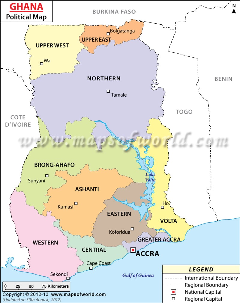
Ghana is a country located in West Africa, along the Gulf of Guinea. Ghana shares borders with Cote d’Ivoire, Burkina Faso, and Togo. Ghana covers an area of 238,535 square kilometers (92,098 square miles) and has a population of about 31.1 million. The capital of Ghana, and its largest city, is Accra.
Ghana is divided into ten administrative regions, and further divided into 138 districts, then towns and councils. The largest region by area is the Northern Region while the smallest is the Greater Accra Area.
| Region | Population | Area(km.²) | Area(mi.²) | Capital |
|---|---|---|---|---|
| Ashanti | 4,780,380 | 24,390 | 9,417 | Kumasi |
| Brong-Ahafo | 2,310,983 | 39,557 | 15,273 | Sunyani |
| Central | 2,201,863 | 9,826 | 3,794 | Cape Coast |
| Eastern | 2,633,154 | 19,977 | 7,713 | Koforidua |
| Greater Accra | 4,010,054 | 2,593 | 1,001 | Accra |
| Northern | 2,479,461 | 70,383 | 27,175 | Tamale |
| Upper East | 1,046,545 | 8,842 | 3,414 | Bolgatanga |
| Upper West | 702,110 | 18,477 | 7,134 | Wa |
| Volta | 2,118,252 | 20,572 | 7,943 | Ho |
| Western | 2,376,021 | 23,921 | 9,236 | Sekondi-Takoradi |
| 10 regions | 24,658,823 | 238,538 | 92,100 |

 Ghana Independence Day