- Malawi Regions - Central, Northern, Southern
- Neighboring Countries - Tanzania, Zambia, Zimbabwe, Mozambique
- Continent And Regions - Africa Map
- Other Malawi Maps - Malawi Map, Where is Malawi, Malawi Blank Map, Malawi Road Map, Malawi Rail Map, Malawi River Map, Malawi Political Map
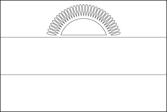
Download Picture of Malawi Flag Outline for kids to color
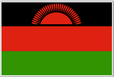
Malawi was earlier a protectorate of Britain and was called Nyasaland. The Malawi flag is modeled on the banner adopted by the Malawi Congress Party which led the struggle for independence.
The black stripe on the Malawi flag stands for the African people. The red color symbolizes the blood shed for their independence struggle. The green color signifies the country’s vegetation. The rising sun is symbolic of the dawn of freedom and hope among the people of the African continent.Black, red and green are considered as the “black liberation” colors.
| Official Name: | Dziko La Malawi |
| Capital: | Lilongwe |
| Location: | In central Africa landlocked by Tanzania, Zambia and Mozambique. |
| Area: | 1,18,480 Sq. km. |
| Official Languages: | English |
| National Flag: | Three equal horizontal stripes of black red rising sun on the center of the black stripe. |
| Flag Ratio: | 2:3 |
| National Anthem: | Oh God Bless Our Land of Malawi (1964) |
| National symbol(s): | lion |
| National colors: | black, red, green, white |
| National anthem: | |
| Name: | “Mulungu dalitsa Malawi” (Oh God Bless Our Land of Malawi) |
| Lyrics/Music: | Michael-Fredrick Paul SAUKA |
Fact about Malawi flag |
| Country | Malawi |
|---|---|
| Designed by | NA |
| Adopted | 6 July 1964 (re-adopted in 2012) |
| Revision | NA |
| Design and Colors | A horizontal triband of black, red, and green; charged with a red rising sun centred on the black stripe |
| Size Ratio | 2:3 |


 History of Malawi