3.9K
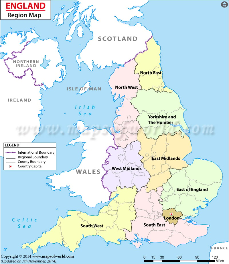
Regions of England
| Regions | Population | Area in Sq.km |
|---|---|---|
| South East | 8,634,750 | 19,095 |
| London | 8,173,941 | 1,572 |
| North West | 7,052,177 | 14,165 |
| East of England | 5,846,965 | 19,120 |
| West Midlands | 5,601,847 | 13,000 |
| South West | 5,288,935 | 23,829 |
| Yorkshire and the Humber | 5,283,733 | 15,420 |
| East Midlands | 4,533,222 | 15,627 |
| North East | 2,596,886 | 8,592 |
previous post
