Thematic maps on physical, economic, political, and social factors are valuable additions in atlases and encyclopedias.
Key Benefits of World Atlas Map
- Our thematic maps on agriculture, climate, minerals, wildlife, and natural disasters enrich the value of school atlases.
- Mapsofworld creates easy-to-read maps on river systems, ocean currents, geological structure, and other themes that can be handed over to students and even their parents.
- We create maps at scales ranging from one million to 10 million and also provide indexes for the maps to be used in atlases.
- The maps we develop for Golf Atlases provide a detailed understanding of the golfing scene around the world.
Potential Users of World Atlas
- Publishers: Flawless cartography in our map-based products is what compels renowned publishers to associate with us.
- School students: Our informative maps aid students in understanding lessons in science and social studies.
- Golfers: Our maps on major golf clubs and impressive golf courses around the world come handy for golfing enthusiasts and professionals.
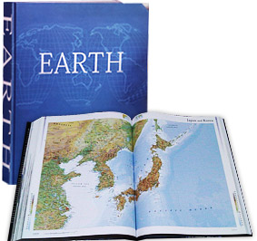
Earth Atlas Millennium House, New South Wales, Australia A considerable huge Atlas of size 18.5 inches x 24 inches, “Earth”; surprisingly, it consists 580 pages and 355 maps covering 194 countries. More than 100 international cartographers, oceanographers, and geographers have contributed in creating this marvel. Our team of cartographers and GIS analysts has worked in tandem with the editors of Millennium House to produce 8 detailed maps of the Asian regions namely West central Asia, East central Asia, North west Asia, North west China, North east China, Middle East, India and Japan. Millennium reposed their reliance on us by getting their subsequent History Atlas; tracing the evolution of people across the world created by us.
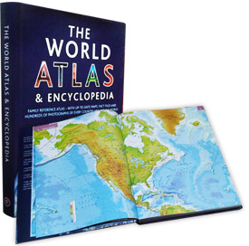
World Atlas & Encylopedia Parragon Books Limited, Bath, United Kingdom Parragon house is the world’s leading publisher of ‘illustrated non-fiction’ books. Our relationship with Parragon commenced with a off- the beat atlas for Golf enthusiasts i.e. “101 Golf Courses” and graduated into a trusted relationship with the end of same project. This Atlas contains 240 maps in total, with double page map openers for continents and the world. Each country is represented with a thumbnail locator map, an illustrated flag, and a country map with interesting facts and figures. The whole Atlas was conceptualized and materialized from scratch by our team of Cartographers, researchers, and editors in tandem with Atlantic publishing. We have not only provided the maps but the fact files and the index as well.
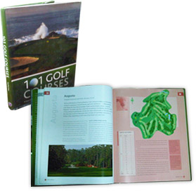
101 Golf Courses Parragon Books Limited, Bath, United Kingdom This book was the beginning of our relationship with Parragon books, UK. Written by Geoffery Giles, the book covers 101 of the best golf courses across the world. Parragon approached us with a project to prepare maps of the Golf courses and we strikingly did the job acceptably in the same way as asked by Parragon. To accomplish the project, our cartographers and designers had to learn basics of Golf to ensure quality maps. Balancing new and old, public and private, world-famous and less-known, each course has been described in detailed and illustrated map of the course showing the holes, the greens, and the overall layout.
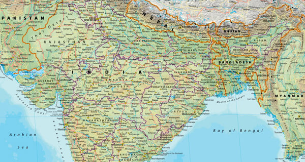

 iPad Applications