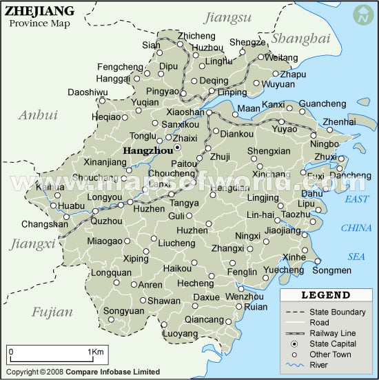
Zhejiang Province Map

Zhejiang lies on the eastern coast of China. In olden times the word “Zhejiang” was used for the Qiantang River, which meant crooked. Qiantang River takes it course through Hangzhou, which is the capital city of Zhejiang. To the north of Zhejiang lies the Shanghai and Jiangsu, on the northwest lies the Anhui, fujian lies to the south of Zhejiang anf j iangx i lies to the west of Zhejiang. East china sea borders the eastern part of Zhejiang.
During the onset of the Spring and autumn period in China Zhejiang emerged as a State of Yue. In 1368, the mongols were driven out by the Ming dynasty and the province of Zhejiang was established.
Zhejiang is a hilly area. The altitude of the place increases while moving towards south and east. Huangyajian Peak is the highest peak in Zhejiang with a height of 1921m. Along the coastlines and the river the area is plain which is mostly the eastern and the northern part of the province as to the east lies the East China Sea and the north is bordered by the southern part of the Yangtze Delta. There are many islands found along the coastline and the Zhoushan Island is the largest of them all and is the third largest island of China. Hangzhou Bay is the largest bay found in this Zhejiang province.
Zhejiang experience a subtropical humid climate. During summer the weather is hot and humid and the temperature is around 27o to 30oC. During winter the temperature falls down to a minimum temperature of 2o to 8o C. Rainfall and typhoons are a common phenomena in summers.
Zhejiang has emerged with a good economic status with its immense production of rice. Fish export also adds to the economy of Zhejiang in a major way. The population of Zhejiang mainly consists of Han Chinese and the people speak Wu. Zhejiang has emerged as a model province in China , with its ever developing economy and hard working people.