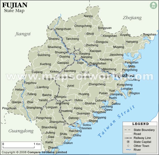
Fujian Province Map

On the southeastern coastal region of the People’s Republic of China lies the province of Fujian . Fuzhou is the provincial capital and the largest city of Fujian . The province of Fujian houses a population of 34 million people approximately.
Fujian derived its name from the first characters of its two popular cities Fuzhou and Jian’ou during the reign of the Tang Dynasty. Some of the other famous dynasties who ruled here include the Qin Dynasty, Han Dynasty, the Northern dynasty, the Southern Dynasty, the Southern Tang, the Ming dynasty, the Qing Dynasty, Southern Song Dynasty and Jurchen Jin Dynasty.
Spread on an area of 121, 400 square kilometers, Fujian has a mountainous topography along with some islands on its coastal regions including the Quemoy Islands, Haitan Island and Nanri Island. Fujian is surrounded by Zhejiang to the north, Jiangxi to the west, and Guangdong to the south. Taiwan is at a distance of 180 km towards east of Fujian. These two places are separated by the Taiwan Strait. Fujian houses nine administrative districts and municipalities including its 64 counties and cities. The most popular cities in Fujian include Fuzhou, Xiamen, Quanzhou, Zhangzhou and Putian.
The People’s Republic of China governs the Fujian province where as the group of islands Quemoy and Matsu are governed by the Republic of China based in Taiwan. The ethnic groups residing in Fujian include Han, She and Hui.
The Fujian province accommodates some of the famous tourist destinations of China namely, Mount Wuyi, Mount Tailao, Gulangyu Island, Kaiyuan Temple and Yongguan Temple.
Agriculture is the basic source of economy of the Fujian Province . Amongst some of the main agricultural products of Fujian are tea, rice, wheat and sugar cane.