John Paul Goode, the accomplished American cartographer, was born in Stewartville in the year 1862. John Paul Goode completed his academics at the University of Minnesota in 1889 and received his doctorate in economics from University of Pennsylvania in the year 190. He served as the professor of geography at the University of Chicago between 1917 and 1928. Prior to this, he instructed students in the subject at University of Chicago between 1901 and 1917.
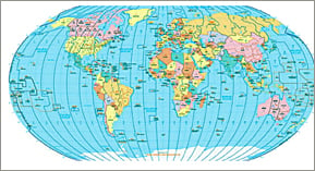
John Paul Goode presented his projection at the American Association of Geographers meet held in Baltimore in the year 1908. The cartographer pointed out the aberration of latitudes in the Polar Regions, as shown in the Mercator projection. The accurate latitude was determined by overlaying the homolographic and sinusoidal projections. He is famed for devising the Goode Interrupted Homolosine projection by combining the homolographic and sinusoidal projections.
John Paul Goode’s homolosine projections are widely used to create maps representing global distribution. In the latter half of his career this reputed cartographer aided in editing various maps and texts on the subject of geography. He compiled the Goode’s School Atlas, which was first published in the year 1923, with the help of his students, Espenshade and Leppard. The edition appears now as the Goode’s World Atlas. John Paul Goode suffered from ill health and breathed his last in the year 1932.
