- Bahrain Cities - Manama
- Neighboring Countries - Qatar, United Arab Emirates, Saudi Arabia, Kuwait, Iran
- Continent And Regions - Asia Map
- Other Bahrain Maps - Bahrain Map, Where is Bahrain, Bahrain Blank Map, Bahrain Road Map, Bahrain Flag
Bahrain is a small island state located near the western shores of the Persian Gulf and covering an area of 290 square miles. It is one of the first countries in the Gulf to benefit from the discovery of oil.
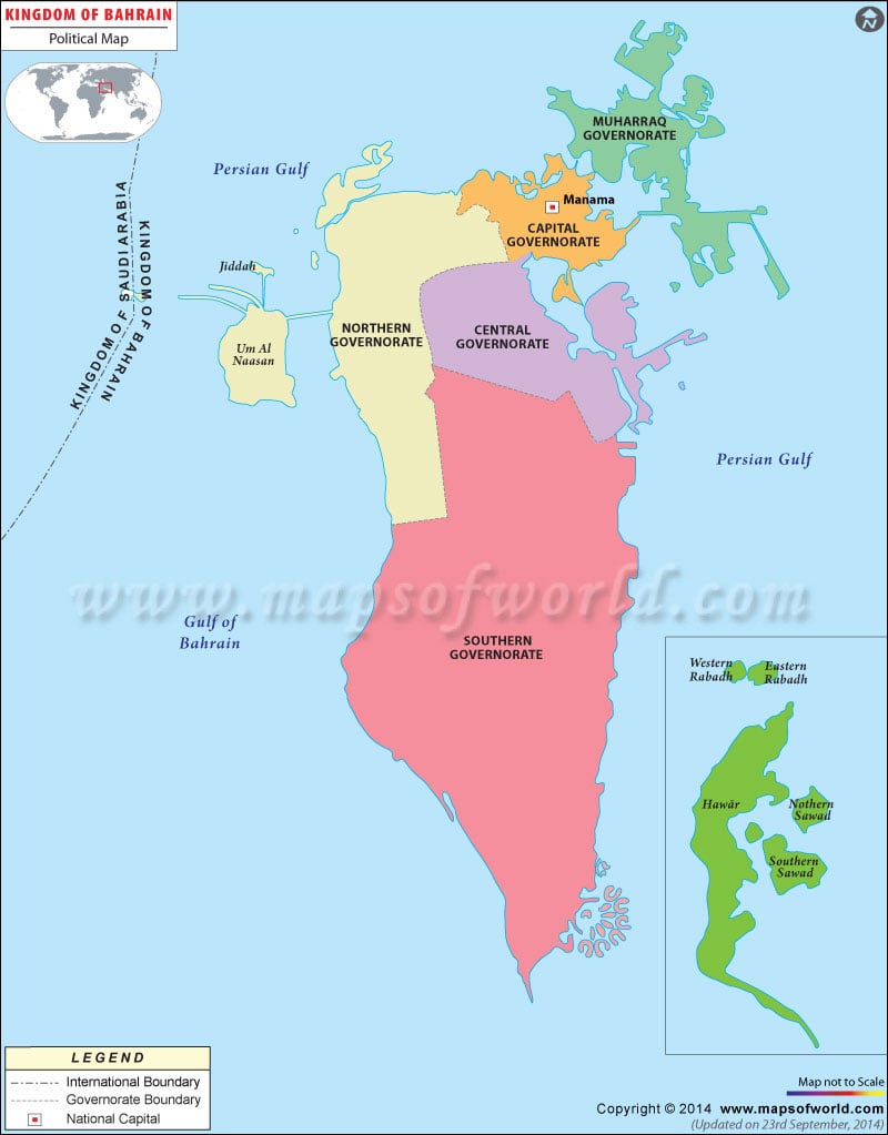
The political map of Bahrain shows the national capital, major cities, and other political divisions of the state.
As shown in the map, Bahrain lies in the Arabian Gulf midway between the Qatar peninsula and Saudi Arabia. It is bordered by Saudi Arabia to the west and the two nations are connected by the King Fahd Causeway. The national capital, Manama is clearly shown in the map.
The other major cities of Bahrain are:
- Muharraq
- Riffa
- Hamad Town
- Jidhafs
- Aali
- Isa Town
- Budaiya
- Adliya
- Isa Town
- Sitra
The island is an archipelago comprising thirty-three islands. Bahrain Island, Muharraq Island, Umm an Nasan, and Sitrah are the largest islands.
Bahrain is a constitutional monarchy. The head of the state is the King; presently Hamad bin Isa Al Khalifa is the King of Bahrain. The Prime Minister of the country is Prince Khalifa bin Salman Al Khalifa. The nation was declared a Kingdom in 2002.
It is one of the most diversified economies in the Persian Gulf with large oil reserves. Petroleum production and refining account for more than seventy percent of government revenues.
| Division | Pop-2010 | Pop-2001 | Arabic |
|---|---|---|---|
| Capital | 329,510 | 163,696 | Al Manamah |
| Central | 326,305 | 167,691 | Al Wusta |
| Muharraq | 189,114 | 103,576 | Al Muharraq |
| Northern | 276,949 | 166,824 | Ash Shamaliyah |
| Southern | 101,456 | 44,764 | Al Janubiyah |
| 5 governorates | 1,234,571 | 650,604 |

 Geography of Bahrain