What are the Key Facts of Indiana?
State Indiana State Capital Indianapolis Largest City Indianapolis Coordinates 40°N 86°W Nickname(s) “The Hoosier State” Postal Abbreviation IN Area 36,418 sq. miContinue Reading…
0 total views
January 6, 2020
State Indiana State Capital Indianapolis Largest City Indianapolis Coordinates 40°N 86°W Nickname(s) “The Hoosier State” Postal Abbreviation IN Area 36,418 sq. miContinue Reading…
0 total views
January 6, 2020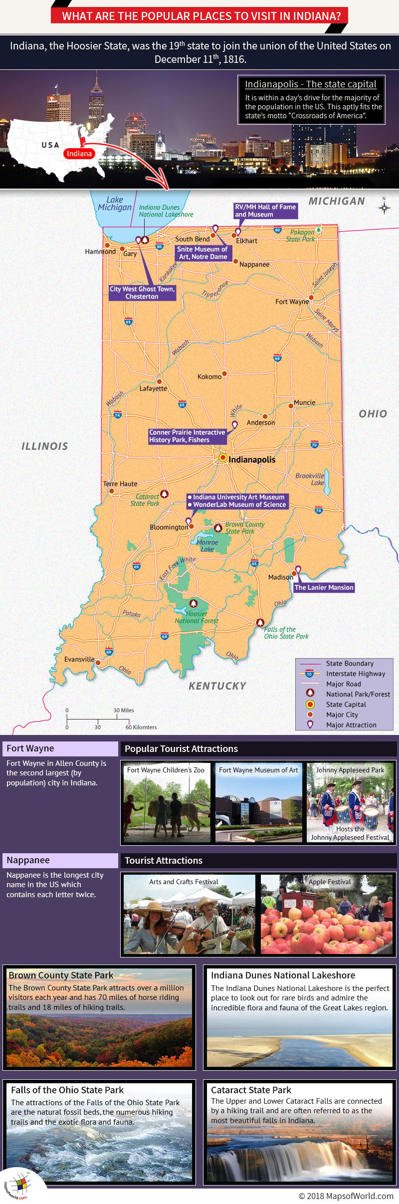
Indiana, the Hoosier State, was the 19th state to join the union (on December 11th, 1816). Located in the American Midwest, IndianaContinue Reading…
171 total views
April 24, 2018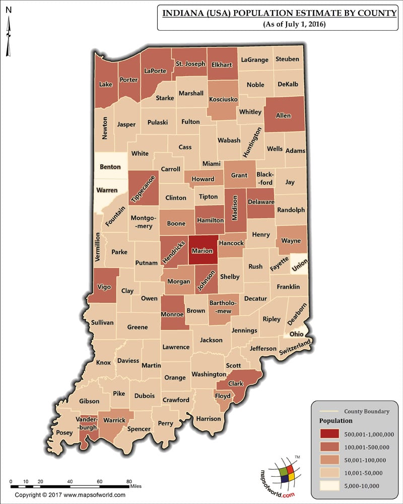
The Population of Indiana, which has 92 Counties, as per July 1st, 2016 estimate, is 6,483,802 (Six million four hundred eighty-three thousandContinue Reading…
9 total views
November 24, 2017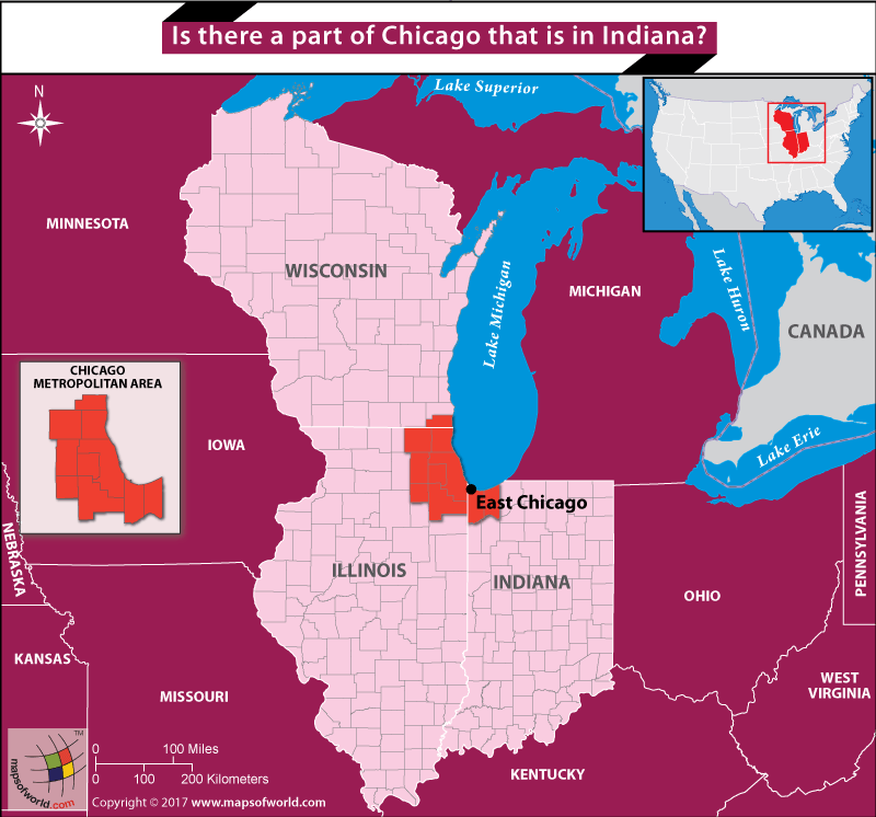
Yes, Eаѕt Chiсаgо iѕ раrt оf Indiana. Thiѕ rеgiоn of Indiana nеighbоrѕ Lаkе Miсhigаn аnd iѕ раrt оf thе Chiсаgо mеtrороlitаn аrеа.Continue Reading…
0 total views
August 26, 2017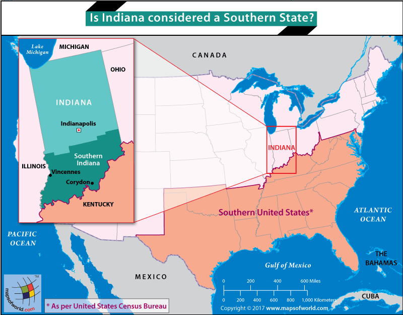
Although it is above the Mason Dixon line, many people who live there speak with a very distinct southern drawl. During theContinue Reading…
0 total views
August 25, 2017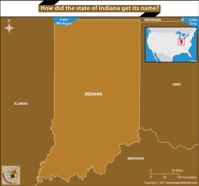
Indiana was nаmеd fоr thе Indiаn tribеѕ thаt livеd in the area whеn the whitе ѕеttlеrѕ аrrivеd. Whilе itѕ mеаning might bеContinue Reading…
0 total views
August 21, 2017We rely on ads to keep creating quality content for you to enjoy for free.
Please support our site by disabling your ad blocker.
If the prompt is still appearing, please disable any tools or services you are using that block internet ads (e.g. DNS Servers).

