Is Antarctica a Desert?
When you think of the word desert, the first image that comes to your mind is that of the vast empty stretches of golden sands, a scorching sun and no water to be found anywhere. But few realize that the world’s largest desert is the cold desert of Antarctica, located concentrically around the South Pole. Despite the land being covered permanently by ice and snow, there is very little precipitation (amounting to less than 1.97 inches or 50 mm a year in the interiors of the continent), qualifying it as a “cold desert.”
In 1953, geographer Peveril Meigs classified deserts into three categories: Extremely arid, arid, and semi-arid. Regions, where there is no precipitation for at least twelve consecutive months, are termed as extremely arid. While arid lands are those that receive less than 9.8 inches (250 mm) of annual rainfall and semi-arid lands are parts of the world that receive an annual precipitation of between 9.8 and 19.7 inches (250 and 500 mm). The former two categories are classified as deserts, while the semi-arid regions are usually grasslands. This classification by Meigs is still widely accepted for classifications of land on the basis of precipitation.
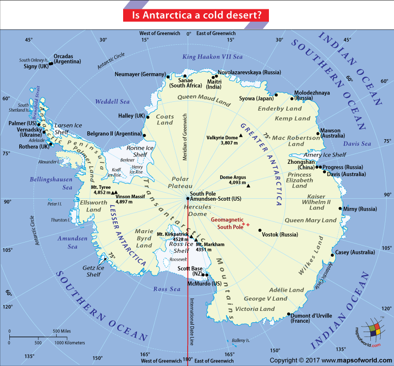
Labeled as the coldest continent on our planet, Antarctica has recorded the coldest temperature on Earth -128.5-degree F (-89.2-degree C) at Antarctica’s Soviet Vostok Station on July 21st, 1983. Some parts of the interior receive as little as .8-inch (20 mm) precipitation annually. The South Pole itself receives less than 4 inches (100 mm) of precipitation annually. Precipitation along the coast is relatively higher, at an average of about 7.9 inch (200 mm) per year. Occasional cases of heavy snowfall and very little rainfall occur only in the coastal regions of the continent. The average annual precipitation of the continent of Antarctica is approximately 6.5 inch (166 mm). This makes Antarctica a true desert as per the classification by Peveril Meigs. Thus, the term calling Antarctica ‘a cold desert’.
Dating back to pre-history, Antarctica was known to be a part of the supercontinent of Gondwanan, which consisted of the current countries of Australia, Africa, South America, India, and New Zealand. The supercontinent’s climate was significantly warmer and wetter with qualities much like that of a rainforest. As the landmass began stretching and rifting, the regions that now make up Antarctica began a slow process of cooling and the weather became more seasonal. By the time Antarctica split, forty million years ago, the first glaciers had already formed and its features were much like they are today: cold and dry.
Antarctica could also be termed as a ‘polar desert’. A polar desert is an area that has precipitation of less than 25 cm (9.84 in.) each year, and an average temperature of under 10 °C during its warmest month. The Earth’s polar deserts cover almost 1,930,500 mi² (5,000,000 km²). Much of the interior of Antarctica is a polar desert.
The continent is also buffeted by strong winds, calm periods are rare, and typically last just a few hours or less. A wind speed of 200 mph (320 km/h) was recorded at the French Dumont d’Urville base in July 1972, thus making Antarctica the windiest continent as well. The winds flow downwards from the interior toward the coast driven largely by gravity as the air cools and becomes denser over the pole. These winds are known as “Katabatic winds,” when they reach the coast, they produce west-flowing ocean current known as the East Wind Drift, as a result of the rotation of the earth, which has an influence far beyond the immediate coastline.
Related Links

