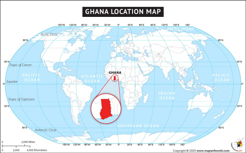
Ghana is a West African country, officially called the Republic of Ghana has constitutional democracy. Bordered by Cote d’Ivoire in the west, Burkina Faso in the north, Togo in the east, and the Gulf of Guinea in the south, Ghana is almost landlocked from three sides. Ghana has only 539 km long coastline. The total area covered by Ghana territory is 238,533 sq. km. making it the eighty second largest country of the world. Geographically Ghana is estimated to be the closest country to the center of the earth. It is also located in closer proximity, north of the equator, thus Ghana mostly has tropical warm climate. The latitudinal extent of Ghana is 4° to 12°N latitudes and 4°W to 2°E longitudes. The prime meridian passes through the town of Tema in Ghana. Accra is the capital city of Ghana.
Ghana’s topography is mostly plains and lowlands with some plateau regions. The world’s largest artificial lake by surface area, Lake Volta is situated in Ghana. Ghana’s wide variety of wildlife and natural diversity is worth a visit to the country. The abundance of natural resources in the country has led to its growing economic development.
Facts About Ghana |
| Country Name | Ghana |
|---|---|
| Continent | Africa |
| Capital | Accra |
| Area | 238,535 sq km (92,099 sq mi) , Water (%) 4.61 (11,000 km2 / 4,247 mi2) |
| Population | 31.1 million (2020 estimate) |
| Lat Long | 8° 00′ N and 2° 00′ W |
| Official Language | English |
| Calling Code | +233 |
| Time Zone | GMT (UTC+0) |
| Airport | 8 Airports |
| Neighboring countries | Côte d’Ivoire, Burkina Faso, Togo |
| Internet TLD | .gh |
| Currency | Ghanaian cedi |

