
World Map Picture
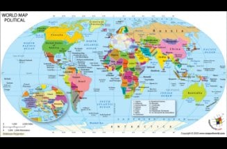
This is a large colored world map showing all the countries in the world with different, distinctive colors. It comes with clear cartography, bold colors, and user-friendly fonts. This high-resolution world map is available in AI, EPS, JPEG, layered PDF formats. You can also customize this map. It showcases countries, boundaries, oceans, seas, Equator, Tropic of Cancer, Antarctic circle, and Arctic Circle.

World Map with Latitude and Longitude
Get the latitude and longitude of the different countries and oceans in the world with this World Map. You can also check out the shape and boundaries of different countries and determine the time zone of specific places. Latitude and Longitude refer to angles, measured in degrees (1 degree = 60 minutes of arc). Know the exact location with latitude and longitude.
Robinson Projection Map
Robinson projection map shows a flat image of the entire world. This large multi-colored world map helps you know about the different countries in the world, their political boundaries, latitude & longitude, and different oceans & seas. You can also know where the Equator, Tropic of Cancer, Antarctic circle, and Arctic Circle are situated and the countries they pass through.

World Political Map
The political map of the world shows the territorial boundaries of the countries, international borders, oceans, seas, islands, territories, and others. This map shows all the independent nations and some dependent territories across the globe (including 193 UN member countries, 2 non-member observer states). All of them are designated with vibrant and contrasting colors. The World Political Map is in Robinson projection.

Map of the World for Kids
This interesting and colorful world map is created especially for the kids to learn the location and boundaries of different countries across the globe. It shows the major wildlife and most popular monuments found in different countries. Different continents, oceans, and seas are also shown on the map. This visual aid will help kids learn in an easy and fun way.

World Map Hemispheres
World Map Hemispheres is a collection of maps showing the Northern Hemisphere, Eastern Hemisphere, Southern Hemisphere, and Western Hemisphere. These maps show the different countries located in different hemispheres, divided by the imaginary lines: the Equator and the Prime Meridian. While the Equator (0º latitude) divides the world into Northern and Southern Hemispheres, Prime Meridian (0º longitude) divides it into Eastern and Western Hemispheres.
-
World Classic Wall Map
$16.95
-
Physical World Wall Map
$33.84
-
World Decorator Wall Map
$16.95
World Atlas
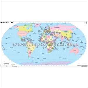
The World Atlas Map gives you a clear view of the different countries in the world, their political boundaries, capitals, oceans & seas, latitude & longitude, and different notional lines such as the Equator, Tropic of Cancer, Antarctic circle, and Arctic Circle and the countries through which they pass. It is a colored map that helps you to identify countries readily.
Asia Pacific Map
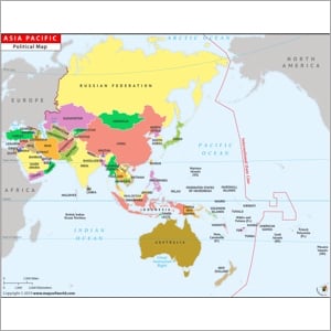
Know about the geographic locations and the political boundaries of different countries and territories in the Asia Pacific region in this colored map. This Asia Pacific Map shows the Oceans (Pacific, Indian, and Arctic), seas (Black Sea, Caspian Sea, Aral Sea, etc.), and parts of North America, Europe, and Africa. It also highlights the International Date Line, equator, Arctic Circle, and Tropic of Cancer.

World Map with Major Cities
The major cities including Tokyo, New York City, Singapore, London, Paris, Sydney, Chicago, Beijing, New Delhi, Bangalore, Kolkata, and many others across the world are shown in this World Map with Major Cities. This colored map shows the different countries, major cities therein, Oceans, seas, latitude/longitude, and many more.

World Map Outline
This is an outline map of the world. It clearly shows different continents, the international boundaries, and the overall shape of different countries in the world. World Map Outline is especially helpful for kids because they can use it for coloring. This outline map provides you with an overview of the world, its water bodies, and different landmasses.
Where are Plateaus Located
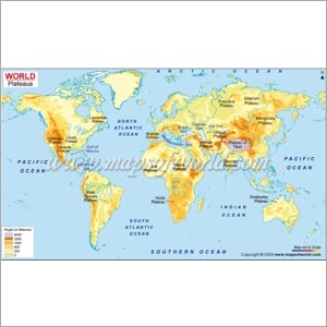
This is a physical map that shows different plateaus located in different countries and continents. Whether it is the Plateau of Tibet in Asia, Mongolian Plateau (China), Laurentian Plateau, Deccan Plateau (India), Marra Plateau (Africa), Kimberley Plateau (Oceania), Mato Grosso Plateau (South America), or others, you can find all of them with the distinction of heights in this World Plateau Map.
Black and White World Map with Countries
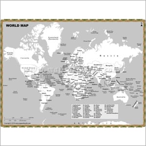
This is a black and white map showing all the countries in the world and their political boundaries. It also shows the different oceans and seas and the locations of different continents, countries, islands, and territories across the globe. Whether larger countries or smaller countries, you’ll find the location, shape, and boundaries of all the countries.
World Map in Different Languages
Find world maps in different languages, be it Hindi, French, Spanish, Swahili, Albanian, or others. Know different aspects (political, physical, and thematic features) of the world map in your own language. Customized world maps in your own language are also available at MapsOfWorld.com.
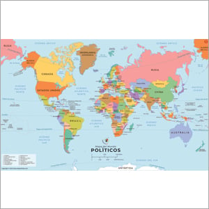
Spanish Language Map
Explore different countries, continents, international borders, islands, territories, water bodies, oceans, seas, and other geographic features across the world in the Spanish language. Spanish is an Ibero-Romance group of languages of the Indo-European family. It is the 2nd most spoken language in the world, spoken by around 500 million people worldwide. Explore World Map (Political) in Spanish.
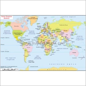
Harta e Botes, World Map in Albanian
If you want to know about different countries, continents, international borders, islands, territories, water bodies, oceans, and seas across the world in the Albanian language (an Indo-European language spoken mainly in South-Eastern Europe), explore Harta e Botes, the World Map in the Albanian language.
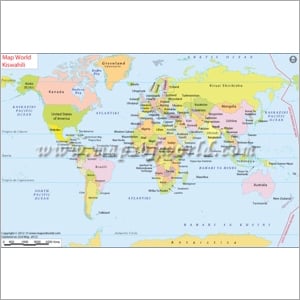
Ramani ya Dunia kwa Kiswahili | World Map in Swahili
Know about different countries, continents, international borders, islands, territories, water bodies, oceans, and seas across the world in the Swahili language. Swahili is a Niger-Congo family of languages spoken in different forms such as Comorian and Kibajuni in Mozambique, Rwanda, Oman, Kenya, Burundi, Comoros, and other regions of Africa. Explore Ramani ya Dunia, the World Map in the Swahili language.
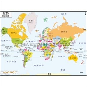
世界 地图 中文
Have a look at different countries, continents, international borders, islands, territories, water bodies, oceans, seas, and other geographic features across the world from this political world map in the Chinese Mandarin language. Mandarin Chinese is a Sino-Tibetan language and the 1st most spoken language in the world, spoken by more than 900 million people worldwide. Explore the World Map in Chinese.
French Language Map
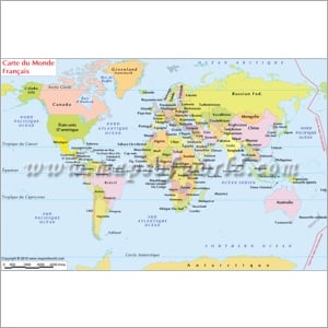
This world map in French shows different countries, continents, international borders, islands, territories, water bodies, oceans, seas, and other geographic features across the world in the French language. French is a Romance language of the Indo-European family. It is the official language in 29 countries including France, Canada, Morocco, etc. Explore Carte du Monde Francais, the World Map in French.
World Map in Hindi
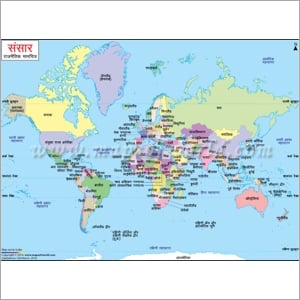
Check out different countries, continents, international borders, islands, territories, water bodies, oceans, seas, and other geographic features across the world from this political world map in the Hindi language. Hindi is an Indo-Aryan language and the 4th most spoken language in the world, spoken by around 340 million people worldwide. Explore Sansar Rajnitik Maanchitra, the World Map (Political) in Hindi.
World Resources Map

World Map with Oceans
Around 70% of the total surface of the earth is covered by oceans. There are 4 major oceans: the Atlantic Ocean, the Pacific Ocean, the Indian Ocean, and the Arctic Ocean. Explore the thematic Oceans map of the world to know where different continents are located with respect to these oceans and the different seas & bays available across the globe.
World Mineral Map
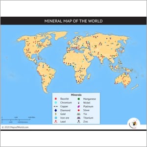
Explore the major mineral, ore deposits, mineral resources, and mines of the world with the help of this World Mineral Map. Know in which continent and location would you find the deposits and mines of bauxite, manganese, nickel, chromium, platinum, copper, titanium, tin, silver, iron ore, gold, diamond, copper, lead iron ore, and many more.
Deserts of the World Map
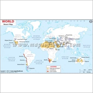
Do you want to know where the deserts are located in different parts of the world? This thematic World Desert Map shows the Subtropical Deserts, Cold Winter Deserts, and Cool Coastal Deserts spread throughout different continents of the world. Most of the subtropical deserts are found in the Sahara region of Africa. Most cold winter deserts are situated in Asia and South America.
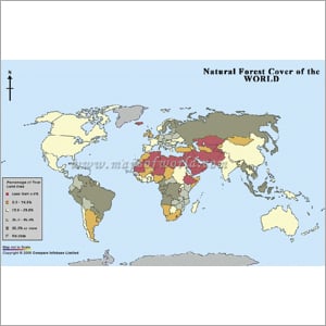
Forests For The World Map
Do you know which areas of the world have the densest forest covers? This thematic world map of forests is a comprehensive guide of forest cover in different parts of the globe. You can know the forest density in different parts of the continents in terms of percentage of total land area: Less than 5%, 5-14.9%, 15-29.9%, 30-49.9%, and 50% and more.
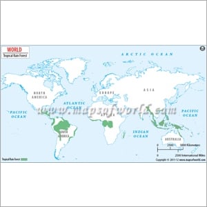
Rainforest World Map
Where are the different tropical rainforests located in different parts of the world? They are mostly found in South America & Central America (Amazon rainforests), Africa, Asia, and Oceania. This thematic Rainforest World Map showcases the different continents, oceans, and rainforests. Rainforests are the richest biodiversity zone of the world that are found mainly between 0° and 30° of both hemispheres.
Thematic Maps of the World
Explore the thematic world maps to know about the wide variety of forests, oceans, rainforests, deserts, minerals, rivers, climate zones, geographical features, and many more theme-based maps. Customized world maps on your preferred theme are also available at MapsOfWorld.com.
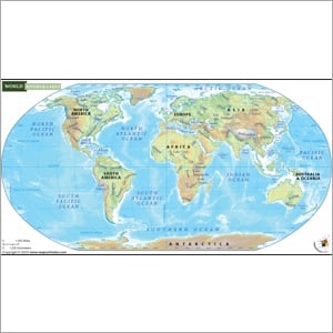
World River Map
Rivers play a major part in the lives of people across the globe. This World river map will help you find the locations, paths, and other details of different major rivers across the globe. This map shows you all the major rivers flowing through the continents, lakes, and oceans. Major rivers are the Nile, Yellow, Yangtze, Amazon, Danube, Volga, Niger, Mississippi-Missouri river system, etc.
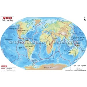
World Fault Lines Map
Fault lines are the crack lines that are created between two tectonic plates of the crust of the earth due to the continuous movement of the rocks. Earthquake Fault Lines Map across the world are shown in this map. Whether it is the fault lines of the African plate, Eurasian plate, Nazca plate, Pacific plate, or others, this map will give you a comprehensive picture of fault lines.
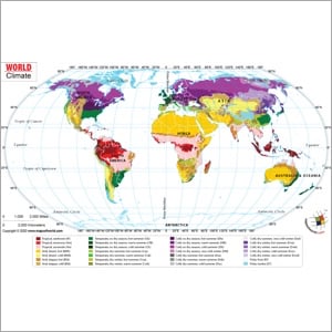
World Climate Map
If you want to know about the climatic conditions in different parts of the world, this colored, thematic World Climate Zones Map will be your perfect guide. The climatic conditions can be broadly divided into tropical, arid, temperate, cold, and polar. However, each of them can again be sub-categorized as per temperature and precipitation. Find all the climate zones in this thematic map.
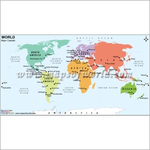
World Map with Capitals
All the major capitals of different countries are pointed on this world map. You can find the major capital cities including Washington D.C., Ottawa, Brasilia, Canberra, Nairobi, Beijing, New Delhi, London, Paris, and many others in different continents (North America, South America, Europe, Africa, Oceania). It also shows different oceans, Antarctica, and many more.
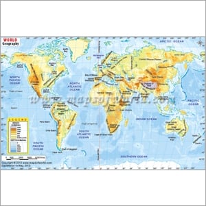
World Geography Map
This world geography map showcases the varied natural landforms and topographical features of different parts of the continents across the world. The elevation and depression on the earth's surface are depicted in this geographical map. You will find the continents, oceans, and heights/depths of different terrain on earth. Find the locations of major mountains, deserts, plains, plateaus, highlands, etc on the world map.
World Travel Maps
The travel maps of MapsOfWorld will help you explore 7 wonders of the world, different mountains, language maps, clock maps, travel maps, airline route maps, and many more travel maps. If you love traveling, you must have these maps with you for a hassle-free tour.
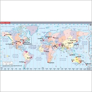
World Clock Map
This map shows the current time of different capital cities across the globe. Get the time of Los Angeles, Chicago, Washington D.C., London, Abu Dhabi, New Delhi, Moscow, Canberra, Brasilia, Tokyo, Abu Dhabi, Jakarta, and many other major cities in this World Clock Map.
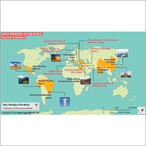
7 Wonders of the World List
The 7 Wonders of the Map shows the wonders of both the ancient and modern world and their locations on different continents. In the modern world, the 7 wonders are the Taj Mahal (India), Chichen Itza (Mexico), Christ the Redeemer (Brazil), Colosseum (Italy), Great Wall of China (China), Machu Picchu (Peru), Petra (Jordan), and Great Pyramid of Giza (Egypt). Explore the 7 wonders of the ancient world too.
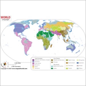
World Language Map
Do you know which languages are spoken by the most people? Mandarin Chinese, Spanish, English, Hindi, and Bengali are spoken by most people across the world. But where are they spoken in different parts of the globe? This World Language Map shows the different languages (Indo-European, Sino Tibetan, and Afro-Asiatic) that are spoken in different parts of the continents.
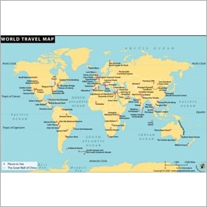
World Travel Map
This World Travel Map shows a wide range of travel maps including major cities, famous museums, honeymoon destinations, landmarks, shopping destinations, world airports, hotels, wonders of the world, and many more. It is a one-stop map for travelers who are looking for a comprehensive map for traveling, attractions, and places to see.
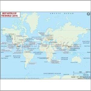
Maps of Hotels
Explore Maps of Hotels to learn everything you want to know about the best hotels in the world. The maps of Hotels section of MapsofWorld provide locations of the best hotels in the world along with information like the hotel’s address, phone number, etc.
World Flight Map
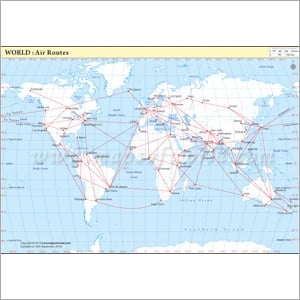
All the main air routes connecting various major cities of the world are depicted by this World Air Routes Map. This map shows the major cities including San Francisco, Singapore, Jakarta, Melbourne, Sydney, Tokyo, London, Paris, New Delhi, Washington D.C., and many others are connected by airline routes. The most popular airlines are American Airlines, Air China, Air France, Deutsche Lufthansa, Japan Airlines, etc.
World Map Mountains
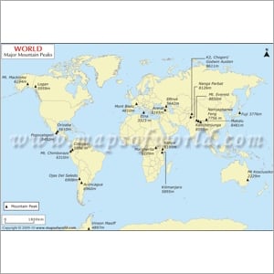
If you want to know the highest peaks across the world, this map is your one-stop guide. Mount Everest has the highest peak in the world at 8,848 meters (29,029 feet). In fact, most of the tallest peaks including Mount Everest, K2, Nanga Parbat, Kanchenjunga, etc. are located in Asia. The other major peaks are Kilimanjaro in Africa, Aconcagua in Argentina, etc.
World Top Ten Maps
The World Top Ten Maps helps you explore the names and locations of the longest rivers, largest Pistachio Producing Countries, beef producing countries, largest oceans in the world, smallest island countries, leading timber-producing countries, and many more. You can also get customized world top 10 maps of your choice from MapsOfWorld.com.
Smallest Island Country
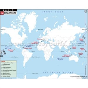
There are many small island countries whose total area is less than 6 sq km each. The Vatican City or Holy See in Southern Europe is the smallest country in the world with a total area of just 0.44 sq km. The other smallest island countries are Howland Island, Monaco, coral sea islands, Jarvis island, and others. Know where they are located on different continents.
Largest Oceans in the World
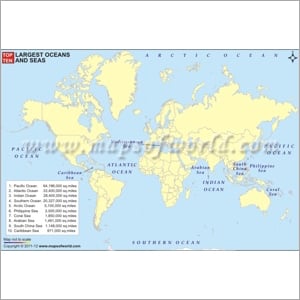
Water covers around 70% of the total surface area of the earth’s surface. Most of them are oceans. The largest oceans in the world are the Pacific Ocean, Atlantic Ocean, Indian Ocean, Southern Ocean, Arctic Ocean, and many more. The Pacific Ocean has an area of around 64,196,000 square miles with a maximum depth of 36,198 ft at Mariana Trench.
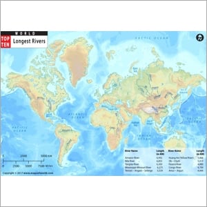
10 Longest Rivers in the World
Do you know which is the longest river in the world and how long is it? Where does it start and where does it end? The Amazon River and Nile River are the longest rivers in the world. Know the names of the 10 longest rivers in the world, their length (in miles and km), their places of origin and places of emptying, drainage area, and average discharge.
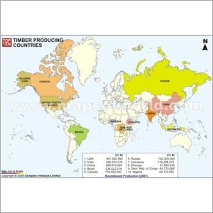
Top 10 Timber Producing Countries
This Top 10 Timber Producing Countries map provides you a visual map of the countries that produce maximum amounts of timber in the world. The United States of America (USA), India, China, Brazil, and Canada produce maximum amounts of timber. Get a quick view of the largest timber-producing countries in this map of the Top 10 Timber Producing Countries.
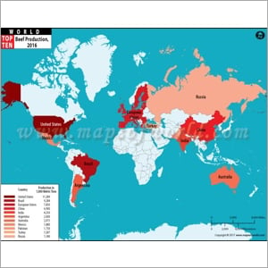
Top 10 Beef Producing Countries
The United States of America (USA) is the top beef producing country in the world with a yearly production of over 11,000 metric tonnes, closely followed by Brazil, the European Union, China, and India. The other largest producers are Argentina, Australia, Mexico, Pakistan, Turkey, and many more. This colored map provides you a map of the top 10 beef-producing countries in the world.
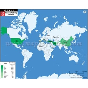
Largest Pistachio Producing Country
Iran is the largest Pistachio producing country with a yearly production of over 400,000 tonnes. The other largest producers are the United States of America, Turkey, China, Syria, and many more. This colored map provides you a map of the top 10 largest Pistachio producing countries in the world.
World Ancient Maps
This is a wide selection of maps depicting different aspects of World Ancient History. You may be aware of different ancient civilizations but do you know about their expanse or geographical reach? This series of World Ancient maps help you know where the different ancient civilizations (Ancient Egypt, Kingdom of Kush, Neo Assyrian Empire, Mauryan Empire, etc.) were located and how far were they spread.
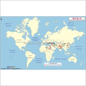
River Valley Civilizations Map
During the first millennium BC, many ancient civilizations emerged along the river beds of major rivers such as the Indus River, the Nile, the Tigris and Euphrates, and the Yellow River. Fresh and clean water near these rivers helped the ancient civilizations sustain and thrive. Know about these civilizations, their locations, and many more from the map.

WW2 Map of Europe
This map of World War 2 (1939-1945) provides details of the most devastating war in modern history. Most of the countries in the world were involved in this war by being part of two opposing military alliances, either the Allies or the Axis Power. This map helps you know the countries on either side, battle sites, Axis-controlled regions, and major cities.
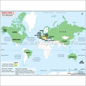
WW2 World Map
The most crucial battles of World War 2 were fought in Europe, the Asia Pacific region, and North Africa between the Allied Power countries against the Axis Power countries. Which are the countries that were part of the Allied Powers or Axis Power? Get a quick view of the countries involved in the most destructive war in modern history.
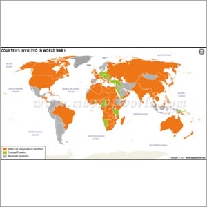
World War 1 Map
World War 1 (WW1) or the First World War was the first-ever war of global scale in modern history involving European countries as well as their colonies. The Great War or “The war to end all wars” mobilized over 70 million military personnel. Which countries were in the Allied Powers and Central Powers? Which countries remained neutral? Know everything in this World War 1 Map.
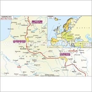
WW1 Map of Europe
World War 1 (WWI or WW1) originated in Europe in mid-1914 and went on for more than 4-years. Over 70 million military personnel, including 60 million Europeans, were involved in this war, making it one of the deadliest conflicts in modern history. This map will help you know the major war fronts and the countries in the Central Powers, Allied Powers, and Neutral Powers.
.jpg)
Countries Involved in World War 1
Do you know which countries were in the Allied and Associated Powers and Central Powers during World War I? Which were the neutral countries? This colored map of countries involved in World War 1 helps you get the answer. This war was the first time in modern history that not only involved the European countries but also their colonies.