History
America was first colonized by Spain in the 1500s, and it established their base in Florida. The population, however, got devastated in the 1600s following a smallpox epidemic. In the same century, slaves were brought here from Africa. Come the 1700s, Britain got control of American territories. Later, the American Revolution began which ultimately forced Great Britain to acknowledge American Independence by the signing of the Treaty of Paris. The constitution for the States was ratified and George Washington was elected the first President. Later on, slavery was prohibited with appropriate amendments in the American Constitution.
The two World Wars are the highlights of the American history in the 20th century. In the first one, the US joined the war by declaring war on Germany and in the second, it dropped the atomic bombs on Hiroshima and Nagasaki in Japan.
In 2001, the USA suffered a major blow as its two buildings - the World Trade Center and the Pentagon were hit by a hijacked aircraft. This led the USA to launch operations in Afghanistan to find Osama Bin Laden, the founder of Al-Qaeda, and defeat the Taliban.
View More...
Geography
Located on the continent of North America, the United States of America has Canada at north, North Atlantic Ocean at the east, Mexico at the south and North Pacific Ocean at the west. Divided into 9 time zones, the country (except Alaska) falls between 50 degrees north and 25 degrees north latitude. Located at 20,310 feet (6,194 m), Mount McKinley in Alaska is the highest point in the country. The lowest point is the Death Valley in California at -279 feet (-85 m).
There are 4 main seasons in the U.S: From April to June, it is Spring; from July to September, it is Summer; from October to December, it is Fall; and from January to March, it is Winter. The mean temperature can range from 11 degrees C in Seattle to -3 degrees C at Fairbanks. Rainfall in the country is seen to be getting reduced from west to east.
The Mid-West is often called ‘Tornado Alley,’ as this zone is tornado-prone, especially in spring. High temperatures (which trigger hurricanes) are felt in the Gulf of Mexico and the Caribbean in late summer and early autumn.
The USA is considered to have a richly diverse ecosystem, more than any other part of the world. The USA has 60 National Parks spread over its states.
View More...
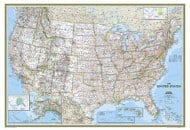
Here is
US Weather Map For Better Information.
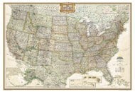
US National Park
The United States is known for the spectacular variety of its natural landscapes, also available in many valleys of the national parks. The captivating scenery and rugged charm of its many natural attractions are best witnessed in the 58 national parks and nature preserves that dot the country. Check this
US National Parks Map locating all the national parks in the US.
USA Culture and Traditions
The USA is a potpourri of various cultures and traditions. Many of its cultural aspects seem to reflect South American, African American, European and Asian influence. The States is also open to all religions and they are practiced freely with complete acceptance and tolerance. Nonetheless, the USA has maintained its identity despite the heavy influence from other cultures. The US has world-famous music, culture, cuisine, art, fashion, and cinema.
View More...
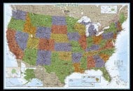
Travel and Tourism
The USA has a lot of gems for a traveler. As of 2014, as many as 6.3 million tourists visited the States. The most visited places in the US are Niagara Falls, Times Square, Navy Pier, New York City, Las Vegas Strip, Great Smokey Mountains National Park, Fisherman's Wharf, Disneyland Park, Lake Buena Vista, Disney World's Magic Kingdom, Faneuil Hall Marketplace, Memorial Parks, and National Mall.
Other Attractions worth visiting are Grand Canyon, Golden Gate Bridge, Yellowstone National Park, Statue of Liberty, Central Park, National 9/11 Memorial & Museum, The Wizarding World of Harry Potter, Alcatraz Island, Lincoln Memorial, The National WWII Museum, and more.
Check this
USA Travel Map is you are planning to visit USA.
Transport and Communication
The longest road network in the world is considered to be in the USA. The US has a road stretch of more than 4 million miles (6,586,610 km), as per the 2012 CIA Factbook. The States also has the world's largest railway network, covering over 180,000 miles (293,564 km). It also has more airports than any other country in the world - 3,513 airports (2013 estimate). It has a number of cargo and passenger ports. There are many important seaports in the country, such as Port of Baton Rouge in Louisiana; Port of Long Beach in California; and Miami Port, Port Everglades and Port Canaveral in Florida.
The international country code for the country is 1. There were, as of July 2016, 395,881,000 mobile cellular connections. '.us' is the Internet country code for the country. There are more than 200 million Internet users in the US.
Read More…
State and Politics
The USA constitutes 50 states. The country enjoys a high literacy rate – 99%. Being a constitution-based federal republic, the USA has a strong democratic tradition. The US Constitution came into effect on 4 March 1789. The US military has many branches, namely, US Army, US Air Force, US Coast Guard and US Navy.
View More...
Interesting USA Facts
- The cuisine is different in each state of the US.
- The coastline of Alaska is longer than the combined coastlines of all the other states.
- There is no official language in the U.S.A.
- “E pluribus unum” is displayed on the Great Seal of the U.S.A. It means “Out of many, one.” Read More Facts here…
US Flag
The current American flag design, which depicts 13 horizontal red & white stripes and 50 white stars in a blue rectangle, was adopted on July 4, 1960. At the time of the adoption of the flag, no meaning to the flag was attached. In 1782, however, the same colors were used in designing the Seal of the United States which were assigned meaning. White represents innocence and purity; Red signifies valor & hardiness; and Blue, signifies justice, perseverance & vigilance. For flags of all states of the USA, check the
Flags of the 50 States.
Economy
The country's GDP (Gross Domestic Product) is $19.36 trillion, as per 2017 estimate. Services sector contributed 80.2%, the industry contributed 18.9% and agriculture contributed 0.9% to the GDP of the country. 79.7% of the labor force in the US is engaged in professional, managerial, and technical activities, 1.5% in farming, fishing, and forestry; 12.7% in mining, manufacturing, and construction, and rest are self-employed.
Total exports for the US in 2017 aggregated to USD 1.576 trillion and imports to USD 2.352 trillion.
View More...
Demography
As of July 2017, the population of the USA is 326,625,791. The birthrate in 2017 was estimated to be 12.5 births per 1,000 population. There were 8.2 deaths per 1,000 of the population for the same considered year. The sex ratio indicates there is 0.97 male per female. The urban population of the country is 82.3% of the total and the rest is rural. Christianity is the main religion in the States. There are also other religions such as Jews, Mormons, Hindus, Buddhists, Muslims, and many other smaller groups.
Read More...