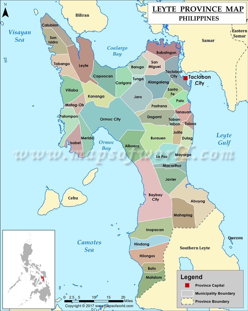
List of Cities/Municipalities in Leyte Province, Philippines |
|||
| City or municipality | Area (sq km) | Area (sq mi) | Coordinates |
|---|---|---|---|
| Abuyog | 688.25 | 265.73 | 10°44′50″N 125°00′41″E |
| Alangalang | 150.54 | 58.12 | 11°12′24″N 124°50′45″E |
| Albuera | 303.35 | 117.12 | 10°55′05″N 124°41′45″E |
| Babatngon | 115.18 | 44.47 | 11°25′24″N 124°50′46″E |
| Barugo | 84.62 | 32.67 | 11°19′30″N 124°44′13″E |
| Bato | 72.45 | 27.97 | 10°19′43″N 124°47′20″E |
| Baybay | 459.34 | 177.35 | 10.6771°N 124.7970°E |
| Burauen | 265.33 | 102.44 | 10°58′27″N 124°53′35″E |
| Calubian | 100.95 | 38.98 | 11°26′45″N 124°25′41″E |
| Capoocan | 185.4 | 71.58 | 11°17′37″N 124°38′34″E |
| Carigara | 117.86 | 45.51 | 11°17′58″N 124°41′20″E |
| Dagami | 161.65 | 62.41 | 11°03′42″N 124°54′09″E |
| Dulag | 110.7 | 42.74 | 10°57′10″N 125°01′56″E |
| Hilongos | 192.92 | 74.49 | 10°22′22″N 124°44′54″E |
| Hindang | 50.04 | 19.32 | 10°26′02″N 124°43′35″E |
| Inopacan | 94.62 | 36.53 | 10°29′57″N 124°44′22″E |
| Isabel | 64.01 | 24.71 | 10°55′30″N 124°26′18″E |
| Jaro | 207.19 | 80 | 11°11′19″N 124°46′56″E |
| Javier (Bugho) | 152.7 | 58.96 | 10°47′39″N 124°56′10″E |
| Julita | 53.3 | 20.58 | 10°58′22″N 124°57′44″E |
| Kananga | 144.2 | 55.68 | 11°11′07″N 124°33′38″E |
| La Paz | 72.7 | 28.07 | 10°53′27″N 124°57′27″E |
| Leyte | 181.26 | 69.98 | 11°22′12″N 124°29′12″E |
| MacArthur | 57.57 | 22.23 | 10°50′05″N 124°59′47″E |
| Mahaplag | 104.79 | 40.46 | 10°36′16″N 124°57′56″E |
| Matag-ob | 104.4 | 40.31 | 11°08′47″N 124°28′22″E |
| Matalom | 132 | 50.97 | 10°16′59″N 124°47′16″E |
| Mayorga | 42.17 | 16.28 | 10°54′10″N 125°00′21″E |
| Merida | 95.21 | 36.76 | 10°54′32″N 124°32′17″E |
| Ormoc | 613.6 | 236.91 | 11°00′16″N 124°36′27″E |
| Palo | 221.27 | 85.43 | 11°09′36″N 124°59′24″E |
| Palompon | 126.07 | 48.68 | 11°03′00″N 124°23′13″E |
| Pastrana | 86.35 | 33.34 | 11°08′12″N 124°53′10″E |
| San Isidro | 122.5 | 47.3 | 11°24′19″N 124°21′08″E |
| San Miguel | 145.11 | 56.03 | 11°17′36″N 124°49′54″E |
| Santa Fe | 53.97 | 20.84 | 11°11′09″N 124°54′55″E |
| Tabango | 96.62 | 37.31 | 11°18′23″N 124°22′19″E |
| Tabontabon | 24.18 | 9.34 | 11°02′30″N 124°57′52″E |
| Tacloban | 201.72 | 77.88 | 11°14′35″N 125°00′29″E |
| Tanauan | 78.41 | 30.27 | 11°06′34″N 125°01′14″E |
| Tolosa | 22.54 | 8.7 | 11°03′41″N 125°02′14″E |
| Tunga | 7.7 | 2.97 | 11°14′54″N 124°45′09″E |
| Villaba | 150.31 | 58.04 | 11°12′47″N 124°23′36″E |
