Map of the World for Kids
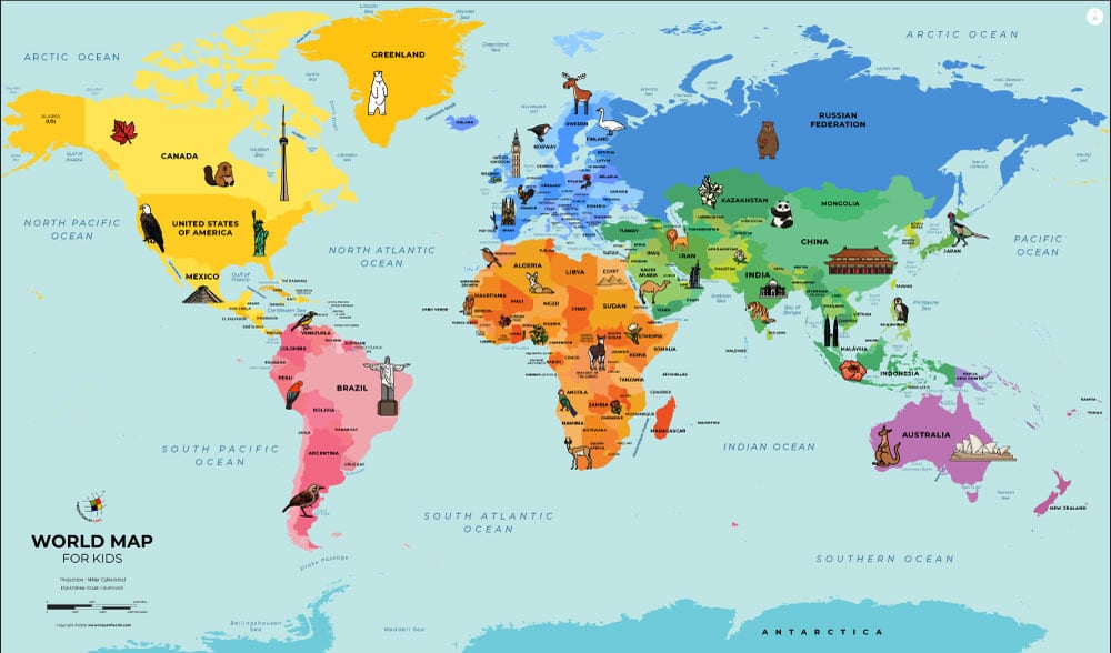
Our Map of the World for Kids shows a view of the world with the North Pole near the top and the South Pole near the bottom. The map also shows an example of the type of wildlife found on each continent.
For more maps like this, make sure to visit our section:
Maps for Kids. You'll find a wide variety of maps, including country-specific maps, thematic maps, and more.
Continent Exploration
Earth's land is separated into seven continents, which are the large land masses shown on the map in various colors on the map. The continents shown on this map are North America, South America, Europe, Asia, Africa, and Antarctica. Sometimes North and South America are considered one continent. Europe and Asia have also been considered one continent due to their connection, but they are culturally distinct.
For more detailed information and map of each continent, check out:
Map of the World Continents. This will provide you with an in-depth exploration of the unique features and characteristics of each continent.
Country Discoveries
Continents are further divided into countries, each with its own government and unique characteristics. From large countries like Russia, spanning both Europe and Asia, to the tiny Vatican City nestled within Italy, children will discover the location of each country on a map.
To explore the world at a country level, you can refer to:
World Map with Countries. This map will allow you to dive deeper into individual countries, their capitals, and other fascinating details.
Related Links


