Driving Directions with Distance Calculator


Leaflet | © OpenStreetMap contributors

World Road maps are a great help to find the way while traveling to different parts of the world. World road maps is a unique section of mapsofworld.com

The various major railway networks of the world are shown in the map. The most dense networks are the ones in USA and Europe, which is natural for these developed regions of the world. At the same time, China, India and

Metro rail systems comprising of underground subway systems and or elevated rail systems, are amongst the fastest, cheapest and most convenient mode of urban transportation.

The distance chart of cities of USA helps one to get a glimpse of the distance between the various cities in USA. These charts are normally preferred over map scales as they are easier to use and take less time.

Map shows a World map where all the major sea ports connecting various cities of the World.

Major World Air Routes Map shows a world map where all the major cities and the air routes connecting them have been shown. The cities shown on this map are Fairbanks, Buones Aires, Cape Town, Jakarta, Perth, Sydney, Melbourne, Perm, Omsk, Jakarta, Singapore, Bangkok, Seoul, Tokyo and Manila.

Find out the nearest airport from your location with this easy-to-use tool. Search with the name of the city, airport or airport code, and an interactive location map of that airport appears.

This interesting section effortlessly shows the actual air distance between any two cities in the world. It is a useful tool for the travelers.

Since the first airship was invented in the mid-1800s humans have been obsessed with air travel. Today, there are hundreds of airlines that offer air travel services, from large

Seaports are facilities located along the coast, which have harbors for transferring people and cargo. Seaports are used to exchange passengers on cruise ships, or drop off and pick up cargo, or for fishermen to haul in the days catch.
Route Planner
Wherever in the world you may be, you're sure to need driving directions when you travel to a new destination.
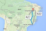
Our easy-to-use Distance Calculators and Route Planners can help make your journey easier. For example, if you wish to drive from New York to Boston, simply click on the USA Route Planner. A box titled 'Calculate distance between US cities' will appear. Select the name of the city you wish to start from and the name of your destination to which you wish to travel by using the drop-down menus in the 'From' and 'To' fields. Once you've selected your origin and destination cities, click on 'Search' and you'll see a map with the shortest route marked on it, the distance measured in miles, and the total time required for the journey in days and hours. You'll also find detailed driving directions which break down the route into short stretches and give you directions, and the distance of each leg of the journey.
Our Distance Calculators include Route Planners for USA, UK,Canada, Spain, Australia, Germany, France, Russia, Italy, Brazil and the London Olympics Venues. You will find detailed driving directions on how to travel from one city to another within any of the countries listed above.
Our Useful Driving Directions section features: road maps, rail network maps, metro rail maps, distance charts of USA cities, world air routes maps, airports maps, airlines information, world air distance locator, world sea ports map, world cruise destinations, USA highway routes, and US interstate highways maps. These maps provide detailed and accurate information of use to travelers worldwide. If you wish to drive across Montenegro or Myanmar, you'll find their road network maps in the road maps section. If you're in Austria or Vietnam and wish to travel by train, you can find maps of their rail networks in our rail network maps section. If you're in Tashket or Teheran and need to find your way around the city using the metro, you'll find their metro maps on our metro rail maps section. Find out about the best cruises in the world with our world cruises map and find detailed maps of US interstate routes in our US interstate highways route maps section. And you can find the distances between cities worldwide from Amsterdam to Tokyo with our world air distance locator. With the help of our travel utilities and detailed driving directions, you're sure to find your way to your destination.


