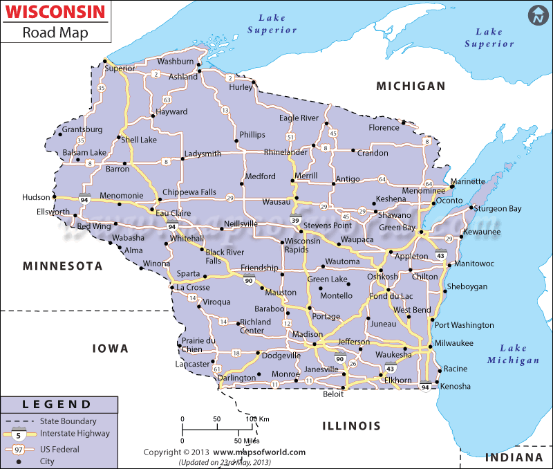
Wisconsin Road Map offers a comprehensive transportation guide, which helps travelers to move around the US state of Wisconsin. Pointing out the major interstate highways of Wisconsin is the main objective of the Wisconsin Road Map. I-90 and I-94 were the first Interstate Highways of Wisconsin state, which were constructed in 1956.
In the later years, the state of Wisconsin was facilitated by interstate 43, which intersected Green Bay, Beloit and Milwaukee. In the year 1990 interstate 39 was built to connect Wausau and Portage and was further extended to Madison. Apart from the State Highways, Wisconsin is also serviced by several US Highways. The US routes of 8, 14, 2, 53, 151, 8, 141, 12, 10, 41, 63, 51, 45 and 61 were made by the federal government of Wisconsin in order to increase the connectivity of the state.
The state Trunkline Highway number 29 is also a major road network of the state. Having a total of 179.779 km of public roads, the state of Wisconsin possesses 45,45,101 number of vehicles, as per an estimate made in 2000. The prime modes of transportation available in Wisconsin include passenger vehicles, trucks and automobiles.
Major towns like Milwaukee, Green Bay, Stevens Point, Eau Claire all are well-connected by the Interstate Highways of Wisconsin. Wisconsin state map is an important indicator of the roadways spread over the total geographical area of the state.
 Wall Maps