1.1K
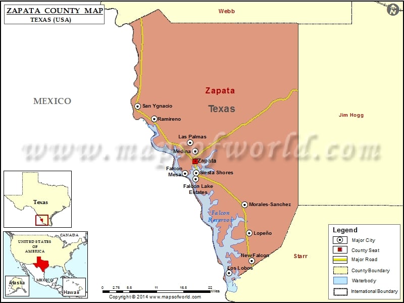
Check this Texas County Map to locate all the state’s counties in Texas Map.
Mountain Peaks in Zapata County
| Mountain Peak/Hill | Elevation [Meter] |
|---|---|
| Loma Blanca | 123 |
| Mendez Hills | 145 |
| Mogotes Hill | 170 |
Airports in Zapata County
| Airport Name |
|---|
| Corralitos Airport |
| Jennings Ranch Airport |
| Zapata County Airport |
Cities in Zapata County
| City | Population | Latitude | Longitude |
|---|---|---|---|
| Falcon Lake Estates | 1036 | 26.871909 | -99.258479 |
| Falcon Mesa | 405 | 26.870641 | -99.290606 |
| Las Palmas | 67 | 26.951633 | -99.276013 |
| Lope▒o | 174 | 26.711834 | -99.100965 |
| Los Lobos | 9 | 26.606536 | -99.161263 |
| Medina | 3935 | 26.929014 | -99.261489 |
| Morales-Sanchez | 84 | 26.787616 | -99.114688 |
| New Falcon | 191 | 26.638338 | -99.094747 |
| Ramireno | 35 | 27.014494 | -99.382198 |
| San Ygnacio | 667 | 27.04804 | -99.432045 |
| Siesta Shores | 1382 | 26.854828 | -99.260516 |
| Zapata | 5089 | 26.902623 | -99.261186 |
Golf Courses in Zapata County
| Name of Golf Course | Latitude | Longitude |
|---|---|---|
| Los Ebanos Golf Course-Zapata | 26.89925 | -99.269139 |
 Wall Maps