2.3K
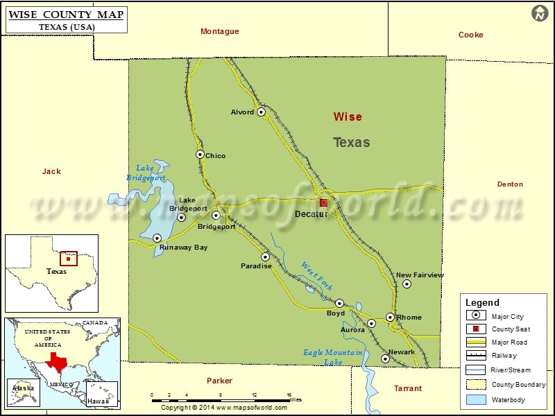
Check this Texas County Map to locate all the state’s counties in Texas Map.
Mountain Peaks in Wise County
| Mountain Peak/Hill | Elevation [Meter] |
|---|---|
| Ball Knob Hill | 361 |
| Bowlin Mound | 319 |
| Brushy Mound | 305 |
| Carlisle Mound | 324 |
| East Mound | 305 |
| Jim Ned Hill | 322 |
| Pat Dick Hill | 291 |
| West Mound | 325 |
Airports in Wise County
| Airport Name |
|---|
| Allison Farm Airport |
| Becker Airport |
| Bishop Airport |
| Carter-Norman Airport |
| Decatur Municipal Airport |
| Eugene’s Dream Airport |
| Fairview Airport |
| Flat Bush Airport |
| Flying S Ranch Airport |
| Heritage Creek Airstrip |
| Howard Field |
| Jackson /Bill/ Airport |
| Jbj Ranch Airport |
| Jim Sears Airport |
| Jw Airport |
| Lake Wohlford Resort Airport |
| Lazy 9 Ranch Airport |
| Lazy G Bar Ranch Airport |
| Mc Entire Airport |
| Red Ace Ranch Airport |
| Rhome Meadows Airport |
| Richey Airfield |
| Spectre Airport |
| Teate Field |
| Vance Field |
| Wise Regional Health System Heliport |
Cities in Wise County
| City | Population | Latitude | Longitude |
|---|---|---|---|
| Alvord town | 1334 | 33.356968 | -97.696026 |
| Aurora city | 1220 | 33.055943 | -97.509615 |
| Boyd town | 1207 | 33.084348 | -97.563209 |
| Bridgeport city | 5976 | 33.209373 | -97.771602 |
| Chico city | 1002 | 33.296223 | -97.799027 |
| Decatur city | 6042 | 33.227634 | -97.589868 |
| Lake Bridgeport city | 340 | 33.20724 | -97.830997 |
| New Fairview city | 1258 | 33.112207 | -97.448809 |
| Newark city | 1005 | 33.00496 | -97.485523 |
| Paradise city | 441 | 33.15034 | -97.688728 |
| Rhome city | 1522 | 33.064645 | -97.477915 |
| Runaway Bay city | 1286 | 33.17736 | -97.870957 |
Golf Courses in Wise County
| Name of Golf Course | Latitude | Longitude |
|---|---|---|
| Bridgeport Country Club-Bridgeport | 33.196647 | -97.754318 |
| Decatur Golf & Country Club-Decatur | 33.265384 | -97.583925 |
| The Club At Runaway Bay-Bridgeport | 33.166036 | -97.881331 |
 Wall Maps