1.4K
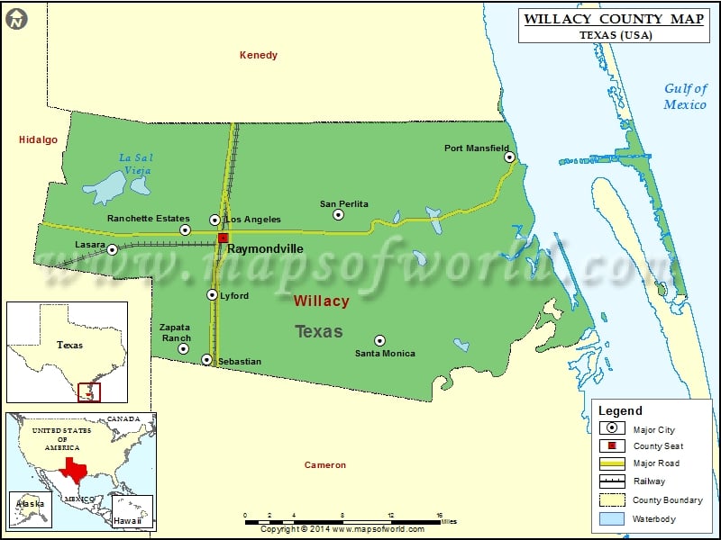
Check this Texas County Map to locate all the state’s counties in Texas Map.
Mountain Peaks in Willacy County
| Mountain Peak/Hill | Elevation [Meter] |
|---|---|
| Green Hill | 3 |
Airports in Willacy County
| Airport Name |
|---|
| Bell Airfield |
| Charles R Johnson Airport |
| T.R. Funk Inc Airport |
Cities in Willacy County
| City | Population | Latitude | Longitude |
|---|---|---|---|
| Lasara | 1039 | 26.463465 | -97.90873 |
| Los Angeles | 121 | 26.494764 | -97.786319 |
| Lyford city | 2611 | 26.414664 | -97.78943 |
| Port Mansfield | 226 | 26.56205 | -97.436181 |
| Ranchette Estates | 152 | 26.484404 | -97.822033 |
| Raymondville city | 11284 | 26.475898 | -97.776925 |
| San Perlita city | 573 | 26.500994 | -97.639648 |
| Santa Monica | 83 | 26.365423 | -97.590032 |
| Sebastian | 1917 | 26.345425 | -97.796401 |
| Zapata Ranch | 108 | 26.356972 | -97.8243 |
Golf Courses in Willacy County
| Name of Golf Course | Latitude | Longitude |
|---|---|---|
| Raymondville Municipal Golf Course-Raymondville | 26.481435 | -97.782442 |
National Parks in Willacy County
| Name of Park | Latitude | Longitude |
|---|---|---|
| Padre Island NS | 27.054559 | -97.357305 |
 Wall Maps