1.4K
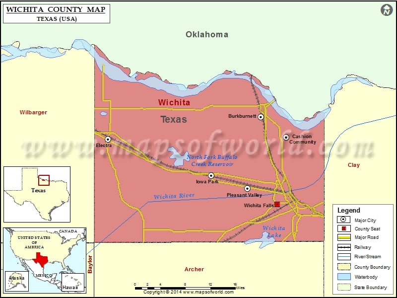
Check this Texas County Map to locate all the state’s counties in Texas Map.
Mountain Peaks in Wichita County
| Mountain Peak/Hill | Elevation [Meter] |
|---|---|
| Bare Butte | 322 |
| Floral Mound | 367 |
| Sunshine Hill | 368 |
| Temple Hill | 321 |
| Twin Mountain | 321 |
Airports in Wichita County
| Airport Name |
|---|
| 4-Shipp Airport |
| Corona Regional Medical Center Heliport |
| Kickapoo Downtown Airport |
| Lucky G Airport |
| Mc Alister Farm Airport |
| Sheppard Air Force Base-Wichita Falls Municipal Airport |
| Wichita Valley Airport |
Cities in Wichita County
| City | Population | Latitude | Longitude |
|---|---|---|---|
| Burkburnett city | 10811 | 34.074758 | -98.567104 |
| Cashion Community city | 348 | 34.036429 | -98.508225 |
| Electra city | 2791 | 34.032102 | -98.920797 |
| Iowa Park city | 6355 | 33.962303 | -98.682009 |
| Pleasant Valley town | 336 | 33.937248 | -98.598275 |
| Wichita Falls city | 104553 | 33.907274 | -98.529298 |
Golf Courses in Wichita County
| Name of Golf Course | Latitude | Longitude |
|---|---|---|
| Crooked Creek Golf Course-Electra | 34.091447 | -98.90654 |
| Hawk Ridge Golf Club-Wichita Falls | 33.944965 | -98.532909 |
| River Creek Park Golf Course-Burkburnett | 34.049897 | -98.4888 |
| The Champions Course At Weeks Park-Wichita Falls | 33.866737 | -98.506405 |
| Wichita Falls Country Club-Wichita Falls | 33.888011 | -98.502986 |
| Wind Creek Golf Course-Sheppard Afb | 33.97225 | -98.511038 |
 Wall Maps