2.4K
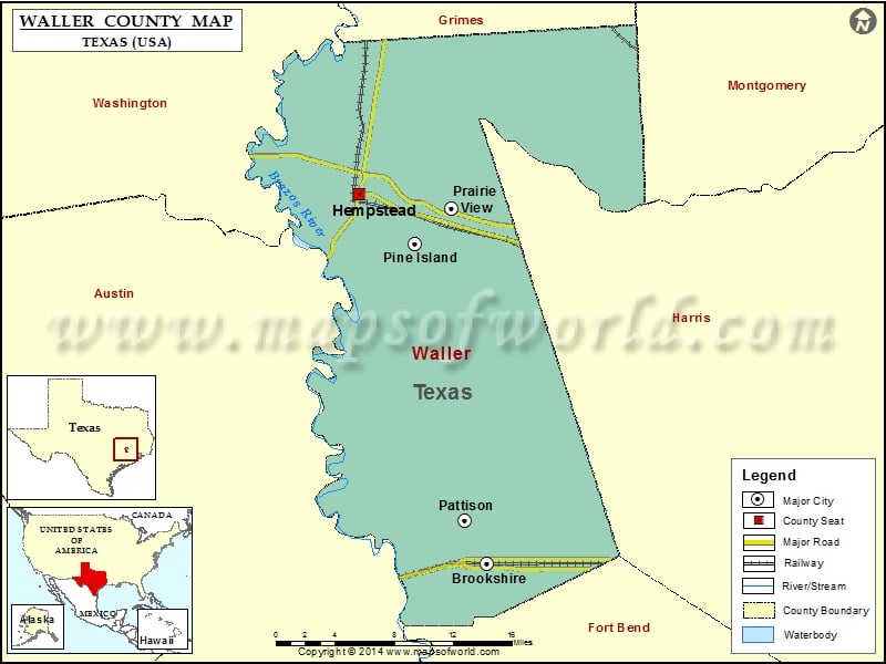
Check this Texas County Map to locate all the state’s counties in Texas Map.
Airports in Waller County
| Airport Name |
|---|
| Biggin Hill Airport |
| Diamond E Ranch Heliport |
| Dry Branch Ranch Airport |
| Fair Weather Field |
| Hempstead Gliderport |
| Houston Executive Airport |
| Jo Na Acres Airport |
| Ken Ada Ranch Airport |
| Laas Farm Airport |
| Mikeska Field |
| Pea Patch Airport |
| Pfeffer & Son Farms Airport |
| Simaron Ranch Airport |
| Skydive Houston Airport |
| Soaring Club of Houston Gliderport |
| Sport Flyers Airport |
| Woods Airport |
| Woods Nr 2 Airport |
| Zadow Airstrip |
Cities in Waller County
| City | Population | Latitude | Longitude |
|---|---|---|---|
| Brookshire city | 4702 | 29.782641 | -95.954486 |
| Hempstead city | 5770 | 30.097423 | -96.079495 |
| Pattison city | 472 | 29.81904 | -95.976009 |
| Pine Island town | 988 | 30.05537 | -96.025328 |
| Prairie View city | 5576 | 30.084973 | -95.989726 |
Golf Courses in Waller County
| Name of Golf Course | Latitude | Longitude |
|---|---|---|
| Fox Creek Golf Club-Hempstead | 30.089885 | -96.043608 |
| Green Meadows Golf Club-Katy | 29.800521 | -95.833674 |
| Houston Oaks Golf Club-Hockley | 30.116723 | -95.843122 |
| Legendary Oaks Golf Course-Hempstead | 30.111387 | -96.097018 |
| Waller Country Club Estates-Waller | 29.998221 | -95.929886 |
 Wall Maps