1K
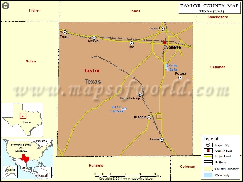
Check this Texas County Map to locate all the state’s counties in Texas Map.
Mountain Peaks in Taylor County
| Mountain Peak/Hill | Elevation [Meter] |
|---|---|
| Bald Eagle Mountain | 693 |
| Bald Mountain | 757 |
| Blowout Mountain | 680 |
| Buzzard Mountain | 721 |
| Castle Peak | 664 |
| Cat Heads | 686 |
| Chalk Peak | 700 |
| Double Gap Mountain | 681 |
| East Peak | 699 |
| Flat Top Mountain | 715 |
| High Lonesome Mountain | 674 |
| Indian Mountain | 696 |
| Riney Peak | 704 |
| Round Top Mountain | 715 |
| Spears Mountain | 671 |
| Steamboat Mountain | 683 |
More Maps of Taylor County
Airports in Taylor County
| Airport Name |
|---|
| Abilene Regional Airport |
| Abilene Regional Medical Center Heliport |
| Dyess Air Force Base |
| Eric Marcus Municipal Airport |
| Flying B Ranch Airstrip |
| Hendrick Medical Center Heliport |
| Sears Airport |
Cities in Taylor County
| City | Population | Latitude | Longitude |
|---|---|---|---|
| Abilene city | 117063 | 32.454651 | -99.738304 |
| Buffalo Gap town | 464 | 32.283579 | -99.834594 |
| Impact town | 35 | 32.500177 | -99.746526 |
| Lawn town | 314 | 32.13657 | -99.750099 |
| Merkel town | 2590 | 32.469733 | -100.011099 |
| Potosi | 2991 | 32.340413 | -99.678936 |
| Trent town | 337 | 32.48841 | -100.123336 |
| Tuscola city | 742 | 32.210629 | -99.799295 |
| Tye city | 1242 | 32.452284 | -99.866611 |
Golf Courses in Taylor County
| Name of Golf Course | Latitude | Longitude |
|---|---|---|
| Abilene Country Club-Abilene | 32.403663 | -99.742281 |
| Diamond Back Golf Club-Abilene | 32.401581 | -99.692948 |
| Fairway Oaks Country Club-Abilene | 32.376814 | -99.759865 |
| Maxwell Golf Course-Abilene | 32.41206 | -99.736206 |
| Mesquite Grove Golf Course-Dyess Afb | 32.426858 | -99.826412 |
| Tin Cup Country Club-Merkel | 32.486803 | -100.012041 |
| Willow Creek Golf Center-Abilene | 32.394903 | -99.737265 |
 Wall Maps