1.7K
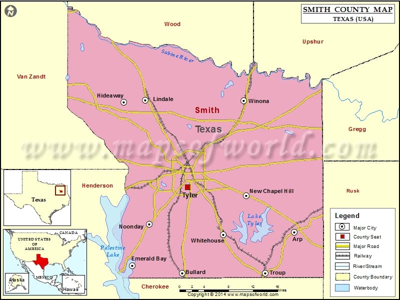
Check this Texas County Map to locate all the state’s counties in Texas Map.
Mountain Peaks in Smith County
| Mountain Peak/Hill | Elevation [Meter] |
|---|---|
| Goodman Mountain | 192 |
| Mount Sinai | 166 |
| Starrville Mountain | 196 |
| Todd Mountain | 185 |
More Maps of Smith County
Airports in Smith County
| Airport Name |
|---|
| Basslake Airport |
| Dps-Tyler Heliport |
| Fraser Farm Airport |
| Headwind Heliport |
| Ina Road Heliport |
| Kay Ranch Airport |
| Mother Frances Hospital Heliport |
| Mother Frances Hospital Heliport |
| Nuttall Airport |
| Oaks Airport |
| Pineridge STOLport |
| Trap Travelstead Field |
| Tyler Pounds Regional Airport |
Cities in Smith County
| City | Population | Latitude | Longitude |
|---|---|---|---|
| Arp city | 970 | 32.227901 | -95.053624 |
| Bullard town | 2463 | 32.145116 | -95.319474 |
| Emerald Bay | 1047 | 32.160166 | -95.438039 |
| Hideaway city | 3083 | 32.488959 | -95.45785 |
| Lindale city | 4818 | 32.493226 | -95.406653 |
| New Chapel Hill city | 594 | 32.299855 | -95.167191 |
| Noonday city | 777 | 32.243999 | -95.396927 |
| Troup city | 1869 | 32.145017 | -95.122366 |
| Tyler city | 96900 | 32.315402 | -95.305009 |
| Whitehouse city | 7660 | 32.221559 | -95.221805 |
| Winona town | 576 | 32.492752 | -95.172962 |
Golf Courses in Smith County
| Name of Golf Course | Latitude | Longitude |
|---|---|---|
| Arrowhead Golf Club-Tyler | 32.362532 | -95.106436 |
| Cascades Golf Club-Tyler | 32.316104 | -95.388961 |
| Emerald Bay Club-Bullard | 32.157607 | -95.435896 |
| Garden Valley Golf Resort-Lindale | 32.480511 | -95.537056 |
| Hide A Way Lake Golf Course-Hideaway | 32.471072 | -95.455584 |
| Hilltop Country Club-Troup | 32.15326 | -95.105444 |
| Hollytree Country Club-Tyler | 32.276424 | -95.31943 |
| Peach Tree Golf Club-Bullard | 32.169395 | -95.326153 |
| Pine Springs Golf Course-Tyler | 32.428172 | -95.265161 |
| The Challenge At Gladewater-Gladewater | 32.48534 | -95.041969 |
| Willow Brook Country Club-Tyler | 32.351562 | -95.335587 |
 Wall Maps