1.6K
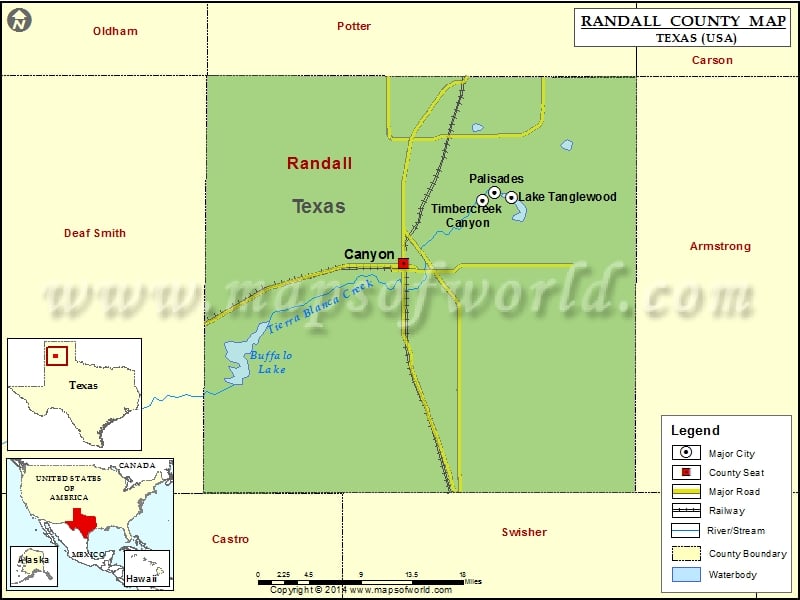
Check this Texas County Map to locate all the state’s counties in Texas Map.
Mountain Peaks in Randall County
| Mountain Peak/Hill | Elevation [Meter] |
|---|---|
| Brushy Butte | 1032 |
| Capitol Mesa | 994 |
| Capitol Peak | 945 |
| Castle Peak | 1002 |
| Cooley Butte | 1034 |
| Goodnight Peak | 1000 |
| Lighthouse Peak | 989 |
| Red Mesa | 1015 |
| Timber Mesa | 988 |
Airports in Randall County
| Airport Name |
|---|
| Blue Sky Airfield |
| Buffalo Airport |
| Flying K Airport |
| Maples Field |
| Palo Duro Airport |
| Tradewind Airport |
Cities in Randall County
| City | Population | Latitude | Longitude |
|---|---|---|---|
| Canyon city | 13303 | 34.987773 | -101.918372 |
| Lake Tanglewood village | 796 | 35.057171 | -101.781727 |
| Palisades village | 325 | 35.061376 | -101.803244 |
| Timbercreek Canyon village | 418 | 35.053805 | -101.818595 |
Golf Courses in Randall County
| Name of Golf Course | Latitude | Longitude |
|---|---|---|
| Canyon Country Club-Canyon | 35.00629 | -101.975391 |
| Comanche Trail Golf Course-Amarillo | 35.175831 | -101.795606 |
| Palo Duro Creek Golf Club-Canyon | 34.994198 | -101.926207 |
| Preston West Par 3 Golf Course-Amarillo | 35.116067 | -101.919687 |
 Wall Maps