1.2K
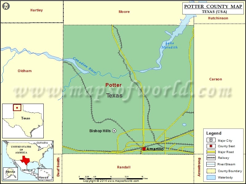
Check this Texas County Map to locate all the state’s counties in Texas Map.
Mountain Peaks in Potter County
| Mountain Peak/Hill | Elevation [Meter] |
|---|---|
| Coyote Bluff | 1088 |
| Goat Mountain | 1156 |
| Hackberry Mesa | 1011 |
| Indian Fort Mesa | 1006 |
| John Ray Butte | 1114 |
| Lost Mesa | 1013 |
| Wolf Mountain | 1124 |
More Maps of Potter County
Airports in Potter County
| Airport Name |
|---|
| Baptist St Anthony’s Hospital Heliport |
| Rick Husband Amarillo International Airport |
Cities in Potter County
| City | Population | Latitude | Longitude |
|---|---|---|---|
| Amarillo city | 190695 | 35.200384 | -101.828293 |
| Bishop Hills town | 193 | 35.261439 | -101.951908 |
Golf Courses in Potter County
| Name of Golf Course | Latitude | Longitude |
|---|---|---|
| Amarillo Country Club-Amarillo | 35.205937 | -101.889603 |
| La Paloma Golf Club-Amarillo | 35.235554 | -101.893854 |
| Ross Rogers Municipal Golf Course-Amarillo | 35.23654 | -101.839706 |
| Tascosa Country Club-Amarillo | 35.188156 | -101.884082 |
National Parks in Potter County
| Name of Park | Latitude | Longitude |
|---|---|---|
| Alibates Flint Quarries NM | 35.581945 | -101.671233 |
| Lake Meredith NRA | 35.619102 | -101.681212 |
 Wall Maps