924
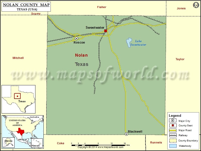
Check this Texas County Map to locate all the state’s counties in Texas Map.
Mountain Peaks in Nolan County
| Mountain Peak/Hill | Elevation [Meter] |
|---|---|
| Beacon Hill | 710 |
| Bench Mountain | 794 |
| Black Point | 725 |
| Cedar Mountain | 717 |
| Church Peak | 698 |
| Cottonwood Mountain | 740 |
| Hylton Mountain | 753 |
| Jackson Mountain | 741 |
| Jackson Mountain | 788 |
| Mathis Mountain | 740 |
| Ninemile Hill | 730 |
| Ringtop | 697 |
| Stepp Mountain | 786 |
| Wildcat Mountain | 775 |
Airports in Nolan County
| Airport Name |
|---|
| Avenger Field |
| Flying W Airport |
| Gesin Ranches Airport |
| Rafter P Airport |
| Rolling Plains Hospital Heliport |
Cities in Nolan County
| City | Population | Latitude | Longitude |
|---|---|---|---|
| Blackwell city | 311 | 32.085054 | -100.319357 |
| Roscoe city | 1322 | 32.440524 | -100.536594 |
| Sweetwater city | 10906 | 32.467474 | -100.410097 |
Golf Courses in Nolan County
| Name of Golf Course | Latitude | Longitude |
|---|---|---|
| Lake Sweetwater Municipal Golf Course-Sweetwater | 32.434131 | -100.320354 |
| Sweetwater Country Club-Sweetwater | 32.49324 | -100.396584 |
 Wall Maps