1.2K
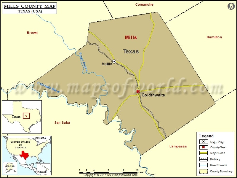
Check this Texas County Map to locate all the state’s counties in Texas Map.
Mountain Peaks in Mills County
| Mountain Peak/Hill | Elevation [Meter] |
|---|---|
| Becker Mountain | 502 |
| Bread Tray Mountain | 504 |
| Cedar Knob | 488 |
| Gobblers Knob | 402 |
| Green Mountain | 407 |
| Hanna Mountain | 427 |
| Huckabee Hill | 520 |
| Little Pompey Mountain | 528 |
| Long Pompey Mountain | 537 |
| Lookout Mountain | 506 |
| Round Mountain | 445 |
| Round Mountain | 470 |
| San Saba Peak | 512 |
| Tiger Mountain | 517 |
| Vinegar Hill | 380 |
Airports in Mills County
| Airport Name |
|---|
| Carlisle Airport |
| Edwards Airport |
| McCasland Ranch Airport |
| Smoky Bend Airport |
| Tin Top Ranch Airport |
| Vaughan Ranch Airport |
Cities in Mills County
| City | Population | Latitude | Longitude |
|---|---|---|---|
| Goldthwaite city | 1878 | 31.452869 | -98.569896 |
| Mullin town | 179 | 31.555205 | -98.665704 |
Golf Courses in Mills County
| Name of Golf Course | Latitude | Longitude |
|---|---|---|
| Goldthwaite Municipal Golf Course-Goldthwaite | 31.468924 | -98.568279 |
 Wall Maps