2.1K
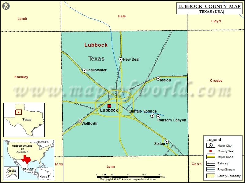
Check this Texas County Map to locate all the state’s counties in Texas Map.
Airports in Lubbock County
| Airport Name |
|---|
| Bartos Farm Airport |
| Bermuda Dunes Airport |
| Blythe Service Center Heliport |
| Department of Public Safety Heliport |
| Everitt Airport |
| Helicopter Transport Inc/Office Heliport |
| Lubbbock Methodist Hospital Heliport |
| Lubbock Preston Smith International Airport |
| Mc Nabb Farm Airport |
| Mdr 1 Heliport |
| Paradise Valley Hosp Emerg Dept Heliport |
| Reese Airpark |
| Slaton Municipal Airport |
| St Mary of the Plains Hospital Heliport |
| Town & Country Airpark |
Cities in Lubbock County
| City | Population | Latitude | Longitude |
|---|---|---|---|
| Buffalo Springs Village | 453 | 33.53278 | -101.707904 |
| Idalou city | 2250 | 33.662497 | -101.683373 |
| Lubbock city | 229573 | 33.566625 | -101.886336 |
| New Deal town | 794 | 33.728226 | -101.83973 |
| Ransom Canyon town | 1096 | 33.530356 | -101.683869 |
| Shallowater city | 2484 | 33.690044 | -101.989131 |
| Slaton city | 6121 | 33.442453 | -101.647278 |
| Wolfforth city | 3670 | 33.514596 | -102.006659 |
Golf Courses in Lubbock County
| Name of Golf Course | Latitude | Longitude |
|---|---|---|
| Chaparral Ridge Golf Course-Lubbock | 33.569813 | -101.939755 |
| Elm Grove Golf Course-Lubbock | 33.564904 | -101.957207 |
| Hillcrest Country Club-Lubbock | 33.641313 | -101.877578 |
| Island Oaks Golf Club-Idalou | 33.696505 | -101.687309 |
| Lake Ridge Country Club-Lubbock | 33.5128 | -101.915105 |
| Lubbock Country Club-Lubbock | 33.631596 | -101.842373 |
| Meadowbrook Canyon Creek-Lubbock | 33.601541 | -101.834272 |
| Reese Golf Center-Lubbock | 33.594282 | -102.026374 |
| Shadow Hills Golf Course-Lubbock | 33.594026 | -101.944292 |
| Slaton Municipal Golf Course-Slaton | 33.45564 | -101.648229 |
| Stone Gate Golf Course-Lubbock | 33.493775 | -101.887854 |
| The Rawls Golf Course-Lubbock | 33.592463 | -101.89721 |
 Wall Maps