1.2K
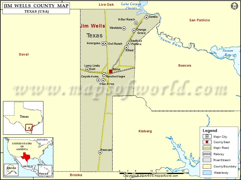
Check this Texas County Map to locate all the state’s counties in Texas Map.
Airports in Jim Wells County
| Airport Name |
|---|
| Alice International Airport |
| Orange Grove Naval Auxiliary Landing Field |
| Seeligson Ranch Airport |
| Spohn-Alice Heliport |
| Weeks Airport |
Cities in Jim Wells County
| City | Population | Latitude | Longitude |
|---|---|---|---|
| Alfred | 91 | 27.874145 | -97.97984 |
| Alice Acres | 490 | 27.711893 | -98.107973 |
| Alice city | 19104 | 27.75559 | -98.065233 |
| Amargosa | 291 | 27.891635 | -98.108638 |
| Coyote Acres | 508 | 27.713178 | -98.134633 |
| K-Bar Ranch | 358 | 27.992808 | -97.926729 |
| Loma Linda East | 254 | 27.766335 | -98.19424 |
| Orange Grove city | 1318 | 27.956203 | -97.938553 |
| Owl Ranch | 225 | 27.892735 | -98.093448 |
| Premont city | 2653 | 27.358606 | -98.124418 |
| Rancho Alegre | 1704 | 27.739292 | -98.102681 |
| Sandia | 379 | 28.019867 | -97.870121 |
| South La Paloma | 345 | 27.894616 | -97.968526 |
| Westdale | 372 | 27.965726 | -97.993728 |
Golf Courses in Jim Wells County
| Name of Golf Course | Latitude | Longitude |
|---|---|---|
| Alice Country Club-Alice | 27.75401 | -98.181884 |
| Alice Municipal Golf Course-Alice | 27.772771 | -98.064817 |
 Wall Maps