1.6K
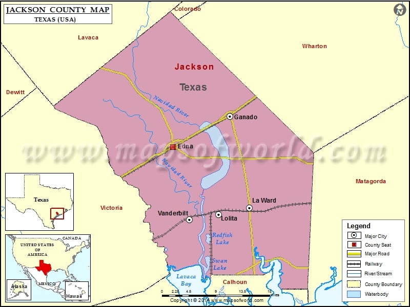
Check this Texas County Map to locate all the state’s counties in Texas Map.
Mountain Peaks in Jackson County
| Mountain Peak/Hill | Elevation [Meter] |
|---|---|
| Old Red Bluff | 6 |
More Maps of Jackson County
- Jackson County Map, Wisconsin
- Jackson County Map, South Dakota
- Jackson County Map, Alabama
- Jackson County Map, Florida
- Jackson County Map, North Carolina
- Jackson County Map, Tennessee
- Jackson County Map, Georgia
Airports in Jackson County
| Airport Name |
|---|
| Cuero Municipal Airport |
| Fenner Ranch Airport |
| Hahns Airport |
| Jackson County Airport |
| Kubecka Flying Service Inc. Airport |
| Whites Airport |
| Wolf Point Heliport |
Cities in Jackson County
| City | Population | Latitude | Longitude |
|---|---|---|---|
| Edna city | 5499 | 28.975699 | -96.648256 |
| Ganado city | 2003 | 29.041246 | -96.511048 |
| La Ward city | 213 | 28.846442 | -96.464876 |
| Lolita | 555 | 28.832574 | -96.53868 |
| Vanderbilt | 395 | 28.820811 | -96.609639 |
Golf Courses in Jackson County
| Name of Golf Course | Latitude | Longitude |
|---|---|---|
| Edna Country Club-Edna | 28.951715 | -96.672528 |
| Ganado Golf & Country Club-Ganado | 29.029317 | -96.500676 |
| Palacios Golf Course-Palacios | 28.73754 | -96.406043 |
 Wall Maps