1.1K
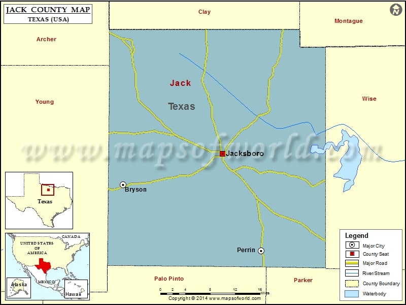
Check this Texas County Map to locate all the state’s counties in Texas Map.
Mountain Peaks in Jack County
| Mountain Peak/Hill | Elevation [Meter] |
|---|---|
| Armstrong Mountain | 365 |
| Backbone Mountain | 338 |
| Bear Knob | 307 |
| Bear Mountain | 438 |
| Bear Mountain | 335 |
| College Hill | 342 |
| Deck Mountain | 423 |
| Galliher Mountain | 375 |
| Gap Mountain | 334 |
| Indian Hills | 396 |
| Mount Lebo | 316 |
| Pitts Mountain | 420 |
| Ross Mountain | 431 |
| Round Mountain | 355 |
| Spie Knob | 383 |
| Tater Hill | 360 |
| Tettertiller Hill | 397 |
| Tripp Hill | 381 |
| Two Bush Knob | 373 |
| Wampler Hill | 377 |
Airports in Jack County
| Airport Name |
|---|
| Flamingo Airfield |
| Flyin Armadillo Airport |
| Jacksboro Municipal Airport |
| One Sixty Four Place Airport |
Cities in Jack County
| City | Population | Latitude | Longitude |
|---|---|---|---|
| Bryson city | 539 | 33.163767 | -98.389198 |
| Jacksboro city | 4511 | 33.22354 | -98.158828 |
| Perrin | 398 | 33.034908 | -98.069205 |
Golf Courses in Jack County
| Name of Golf Course | Latitude | Longitude |
|---|---|---|
| Mitchell Resort and RV Park Par 3-Perrin | 33.033837 | -98.02326 |
 Wall Maps