1.6K
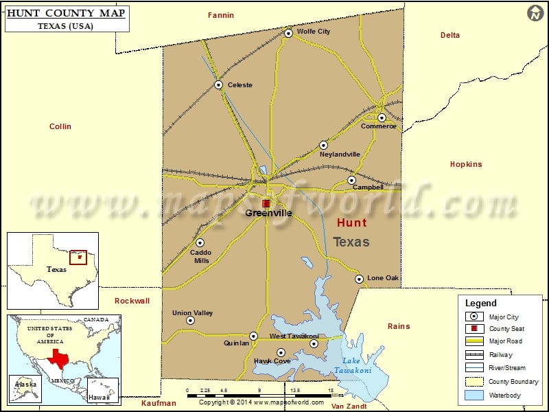
Check this Texas County Map to locate all the state’s counties in Texas Map.
Airports in Hunt County
| Airport Name |
|---|
| Bishop Field |
| Caddo Mills Municipal Airport |
| Card Aerodrome |
| Chambers Airport |
| Commerce Municipal Airport |
| Eds Administration Nr 2 Heliport |
| Fly-N-Ski Airport |
| Flyers Field |
| Flying ‘T’ Ranch Airport |
| Flying M Airport |
| Glenmar Airport |
| Henington Airport |
| Jacobia Field |
| Magee Airport |
| Majors Airport |
| Meadowview Airport |
| Mynatt Field |
| Phillips Flying Ranch Airport |
| Presbyterian Hospital of Commerce Heliport |
| Presbyterian Hospital Of Greenville Heliport |
| Psf Heliport |
| Reeder Airport |
| Skinner Airport |
| Taylor Airport |
| Thorny Woods Airport |
| Weedfalls Airport |
| Weese International Airport |
Cities in Hunt County
| City | Population | Latitude | Longitude |
|---|---|---|---|
| Caddo Mills city | 1338 | 33.051705 | -96.230065 |
| Campbell city | 638 | 33.146326 | -95.954436 |
| Celeste city | 814 | 33.291733 | -96.196234 |
| Commerce city | 8078 | 33.241997 | -95.899858 |
| Greenville city | 25557 | 33.11151 | -96.109433 |
| Hawk Cove city | 483 | 32.883582 | -96.083125 |
| Lone Oak city | 598 | 32.995987 | -95.941016 |
| Neylandville town | 97 | 33.200541 | -96.005606 |
| Quinlan city | 1394 | 32.908916 | -96.131865 |
| Union Valley city | 307 | 32.932311 | -96.247228 |
| West Tawakoni city | 1576 | 32.897422 | -96.02338 |
| Wolfe City city | 1412 | 33.370558 | -96.068693 |
Golf Courses in Hunt County
| Name of Golf Course | Latitude | Longitude |
|---|---|---|
| Hartline’s Golf Center-Greenville | 33.131483 | -96.010714 |
| Lone Oak Golf Club-Lone Oak | 32.98687 | -95.980375 |
| Oak Creek Country Club-Greenville | 33.07273 | -96.091314 |
| Sand Hills Golf & Country Club-Campbell | 33.195951 | -95.910916 |
| Tawakoni Golf Course-West Tawakoni | 32.903477 | -96.004838 |
| Webb Hill Country Club-Wolfe City | 33.311454 | -96.1025 |
| Wright Park Municipal Golf Course-Greenville | 33.029543 | -96.003431 |
 Wall Maps