915
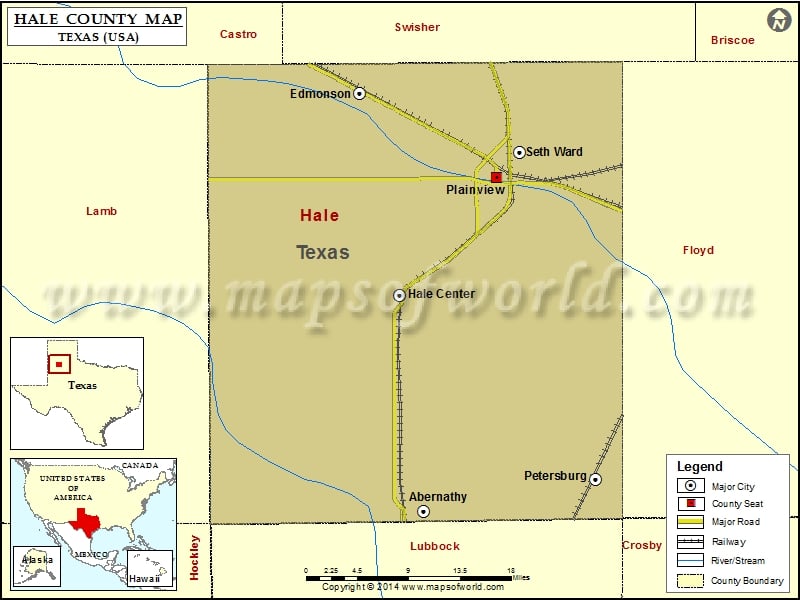
Check this Texas County Map to locate all the state’s counties in Texas Map.
Airports in Hale County
| Airport Name |
|---|
| Abernathy Municipal Airport |
| Buddy Harmel Airport |
| Hale County Airport |
| Horan Airport |
| Laney Farm Airport |
| Quarterway Airport |
| St John’s Regional Medical Center Heliport |
| True Airport |
More Maps of Hale County
Cities in Hale County
| City | Population | Latitude | Longitude |
|---|---|---|---|
| Abernathy city | 2805 | 33.832354 | -101.845802 |
| Edmonson town | 111 | 34.279108 | -101.896666 |
| Hale Center city | 2252 | 34.066107 | -101.84626 |
| Petersburg city | 1202 | 33.871049 | -101.597292 |
| Plainview city | 22194 | 34.190899 | -101.723442 |
| Seth Ward | 2025 | 34.216345 | -101.694463 |
Golf Courses in Hale County
| Name of Golf Course | Latitude | Longitude |
|---|---|---|
| Abernathy Country Club-Abernathy | 33.83141 | -101.838318 |
| Plainview Country Club-Plainview | 34.183013 | -101.737874 |
 Wall Maps