888
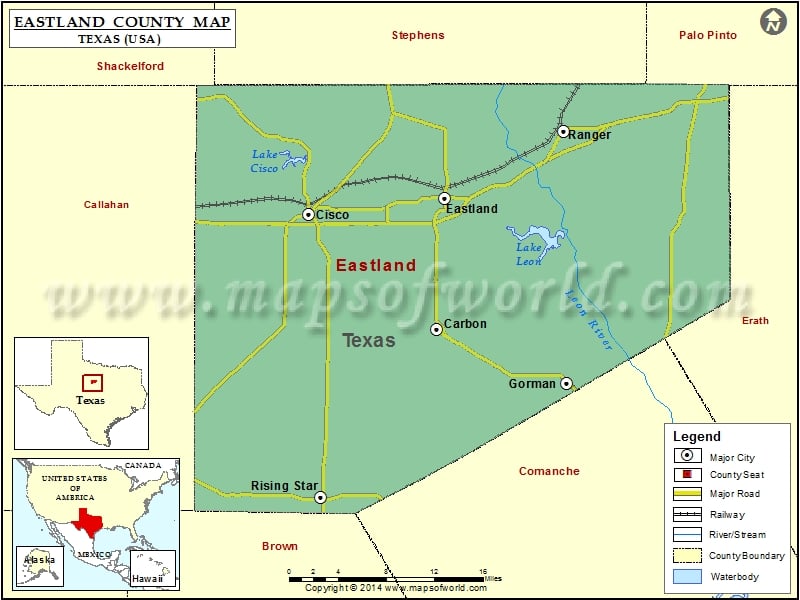
Check this Texas County Map to locate all the state’s counties in Texas Map.
Mountain Peaks in Eastland County
| Mountain Peak/Hill | Elevation [Meter] |
|---|---|
| Bear Mountain | 399 |
| Cedar Mountain | 494 |
| Coyote Peak | 571 |
| Flat Top Mountain | 475 |
| Gunsight Mountain | 503 |
| Jameson Peaks | 507 |
| Mockingbird Hill | 412 |
| Rattlesnake Mountain | 482 |
| Round Mountain | 461 |
| Washout Mountain | 393 |
Airports in Eastland County
| Airport Name |
|---|
| Cisco Municipal Airport |
| Cook Canyon Ranch Airport |
| Eastland Municipal Airport |
| Ranger Municipal Airport |
Cities in Eastland County
| City | Population | Latitude | Longitude |
|---|---|---|---|
| Carbon town | 272 | 32.268405 | -98.827196 |
| Cisco city | 3899 | 32.384807 | -98.980506 |
| Eastland city | 3960 | 32.401538 | -98.817336 |
| Gorman city | 1083 | 32.213538 | -98.672077 |
| Ranger city | 2468 | 32.469291 | -98.675167 |
| Rising Star town | 835 | 32.097634 | -98.96652 |
Golf Courses in Eastland County
| Name of Golf Course | Latitude | Longitude |
|---|---|---|
| Lake Cisco Country Club-Cisco | 32.39191 | -98.982384 |
| Lakeside Country Club-Eastland | 32.41524 | -98.832611 |
| Lone Cedar Country Club-Eastland | 32.39578 | -98.721219 |
| Rolling Oaks Golf Club-Rising Star | 32.09204 | -98.990439 |
 Wall Maps