1.2K
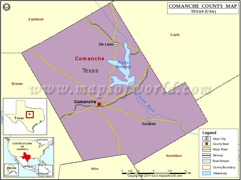
Check this Texas County Map to locate all the state’s counties in Texas Map.
Mountain Peaks in Comanche County
| Mountain Peak/Hill | Elevation [Meter] |
|---|---|
| Cowhouse Mountain | 509 |
| Indian Mountain | 440 |
| Long Mountain | 562 |
| Round Mountain | 554 |
| Sand Mountain | 441 |
| Schoen Mountain | 509 |
| Slick Hill | 439 |
| Taterhill Mountain | 510 |
Airports in Comanche County
| Airport Name |
|---|
| Comanche County City Airport |
| Comanche Hospital Heliport |
| De Leon Municipal Airport |
| Harley White Field |
| Sears Airport |
| Smith Flying Service Airport |
| Yoakum Airport |
Cities in Comanche County
| City | Population | Latitude | Longitude |
|---|---|---|---|
| Comanche city | 4335 | 31.900479 | -98.604363 |
| De Leon city | 2246 | 32.11135 | -98.535156 |
| Gustine town | 476 | 31.845689 | -98.402529 |
Golf Courses in Comanche County
| Name of Golf Course | Latitude | Longitude |
|---|---|---|
| P A R Country Club-Comanche | 31.93568 | -98.505479 |
 Wall Maps