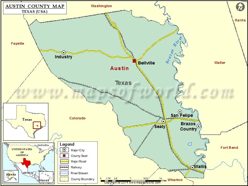
About Austin County
Austin County is a county located in the southeastern part of the state of Texas, and its county seat is Bellville. The area is known for its rich history, with landmarks such as the Stephen F. Austin State Park and the San Felipe de Austin State Historic Site. The county is also home to several higher education institutions, including Blinn College and the University of Texas at Austin. The Austin County map shows major highways and transportation networks that connect the area to other parts of Texas and the United States. The region offers a high quality of life with excellent schools, parks, and cultural amenities, and is a hub for technology, healthcare, and other industries.
Mountain Peaks in Austin County
| Mountain Peak/Hill | Elevation [Meter] |
|---|---|
| Red Hill | 94 |
Airports in Austin County
| Airport Name |
|---|
| Brandes Air Field |
| Clark Sky Ranch Airport |
| Eberly Ranch Airport |
| El Paisano Airport |
| Ghsa-Wallis Glideport Gliderport |
| Gloster Aerodrome |
| Grawunder Field |
| Hinson Airport |
| Longbird Airport |
| Mario’s Flying Pizza Airport |
| Rabb And Nobra Airport |
| Traylor Tick Farm Airport |
Cities in Austin County
| City | Population | Latitude | Longitude |
|---|---|---|---|
| Bellville city | 4097 | 29.947162 | -96.25972 |
| Brazos Country city | 469 | 29.754739 | -96.042274 |
| Industry city | 304 | 29.971491 | -96.499086 |
| San Felipe town | 747 | 29.796344 | -96.105309 |
| Sealy city | 6019 | 29.76612 | -96.161639 |
| Wallis city | 1252 | 29.631653 | -96.063736 |
Golf Courses in Austin County
| Name of Golf Course | Latitude | Longitude |
|---|---|---|
| Bellville Golf & Rec. Club-Bellville | 29.965799 | -96.279819 |
| River Ridge Golf Club-Sealy | 29.757658 | -96.039866 |
| Stephen F Austin Country Club-San Felipe | 29.81204 | -96.108202 |
 Wall Maps