2.5K
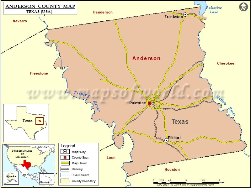
Check this Texas County Map to locate all the state’s counties in Texas Map.
Airports in Anderson County
| Airport Name |
|---|
| Deer Meadow Ranch Airport |
| Glad Oaks Airport |
| Lochridge Ranch Airport |
| Meadowood Ranch Heliport |
| Palestine Municipal Airport |
| Palestine Regional Medical Center Heliport |
| W J E Airport |
More Maps of Anderson County
Cities in Anderson County
| City | Population | Latitude | Longitude |
|---|---|---|---|
| Elkhart town | 1371 | 31.627968 | -95.578968 |
| Frankston town | 1229 | 32.056093 | -95.50436 |
| Palestine city | 18712 | 31.754715 | -95.647174 |
Golf Courses in Anderson County
| Name of Golf Course | Latitude | Longitude |
|---|---|---|
| Elkhart Golf Club-Elkhart | 31.628314 | -95.554025 |
| Meadowbrook Country Club-Palestine | 31.796163 | -95.630481 |
| Pine Dunes Resort-Frankston | 32.06557 | -95.501436 |
 Wall Maps