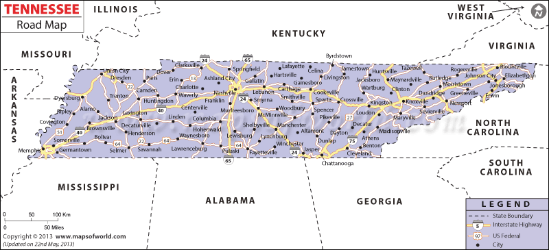
Tennessee to join as the sixteenth state in the union is located in the southern parts of United States. Transport of Tennessee is greatly dependent on the Tennessee road network where interstate highways are the backbone of the Tennessee road network.
Tennessee road map indicates all the national highways like I65, I75, I24 and I40, major roads, Nashville the states capital and all the major towns of the state like Memphis, Knoxville and Chattanooga. Tennessee road map shows the political boundaries of the state along with its neighboring states of Kentucky, Missouri, Arkansas, Mississippi, Alabama, Georgia, North Carolina and Virginia.
Interstate Highways in Tennessee
- Interstate 24 map
- Interstate 40 map
- Interstate 65 map
- Interstate 75 map
List of state routes in Tennessee:
US Highways and State Routes: Route 11, Route 11E, Route 11W, Route 19E, Route 23, Route 25E, Route 27, Route 31, Route 31E, Route 41, Route 41A, Route 45, Route 45E, Route 45W, Route 51, Route 64, Route 70, Route 70N, Route 70S, Route 79, Route 127, Route 129, Route 176, Route 231, Route 321, Route 411, Route 412, Route 421, Route 431 and Route 641.
 Wall Maps