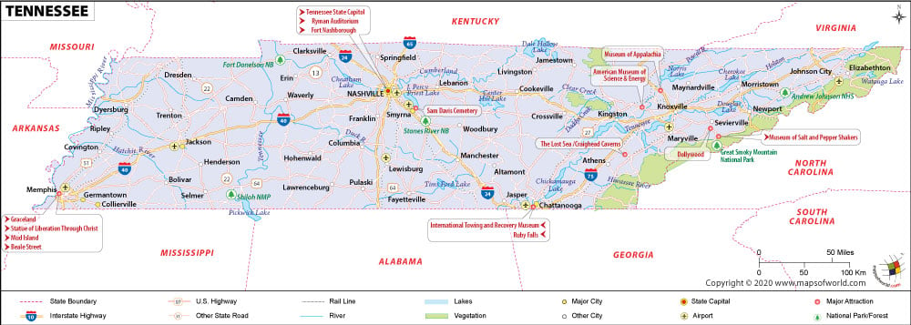
Nicknamed ‘The Volunteer State’, Tennessee is famous for down-home southern cuisine, oak-barrel-aged whiskey, and soul-saving rockabilly music. The “Birthplace of the Blues Music,” Memphis is the largest city in the state. Nashville, the state capital, is the second largest city in Tennessee. The city of Bristol is referred as the “Birthplace of Country Music.”
From the Great Smokies in the east to the Mississippi River in the west, Tennessee is a state of many facets. There are 95 counties in the state. The Shelby County is the largest county both by area and population. At an elevation of 2,025 meters, Clingmans Dome is the highest point in Tennessee.
Tourist Attractions in Tennessee
- Great Smoky Mountains National Park
- Elvis Presley’s Graceland
- National Civil Rights Museum
- Dollywood in Pigeon Forge
- Parthenon in Centennial Park
- Cherokee National Forest
- Ober Gatlinburg Amusement Park
- Beale Street Historic District
Memphis International Airport (MEM) and Nashville International Airport (BNA) are the busiest airports in Tennessee.
Amtrak’s City of New Orleans stops at Newbern Depot and Memphis Central Station.
Interstate Highways I-40, I-24, I-75, and I-65 and a few U.S. Highways traverse the state.
 Wall Maps