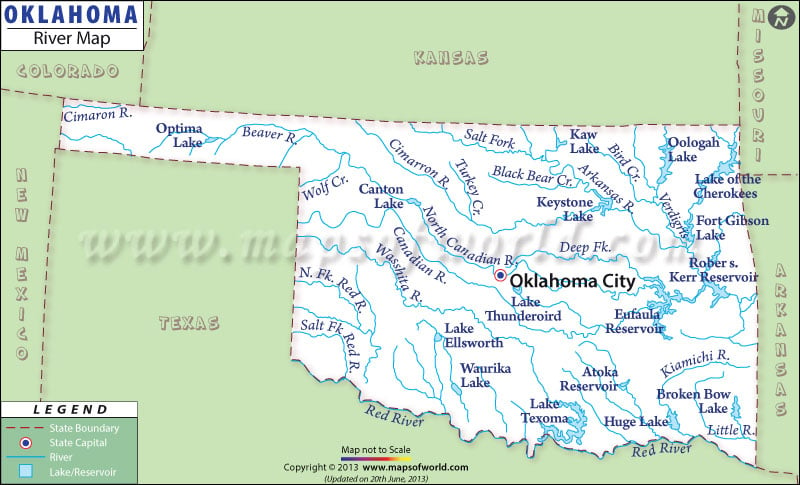
The Oklahoma River Map clearly mentions the rivers, lakes and streams of the state. The State of Oklahoma is drained by several rivers. Some of the important rivers flowing across the state are River Canadian, River Arkansas and River Red. Oklahoma falls under the watershed drainage area of the Gulf of Mexico.
The Arkansas flows through almost two-third parts of the state. River Verdigris, River Illinois and River Grand join River Arkansas in the northern and northeastern part of the state. In the western and north-western region of Oklahoma, River Cimarron and River Canadian join the Arkansas.
River Red flows along the southern front of Oklahoma and meets River Washita, River Kiamichi, River Blue and River Salt Fork. Oklahoma has many man-made and natural lakes. Some of the prominent lakes of Oklahoma are Gibson Lake, Texoma Lake, Keystone Lake, Waurika Lake, Broken Bow Lake, Eufaula Lake, Lake O the Cherokees and Hudson Lake.
Encompassing a total surface area of 41,500 hectares, Lake Eufaula is the biggest artificial lake of the State of Oklahoma. The Oklahoma State Map points out the small and large rivers of the state. Some of the other important rivers draining Oklahoma are River Beaver and River Caney.
 Wall Maps